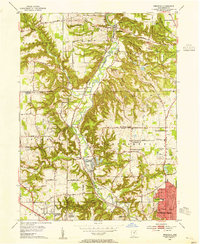
1953 Map of Peninsula
USGS Topo · Published 1955About this map
The Cuyahoga River valley in the mid-1950s is defined by its deep incisions through the terrain, featuring a parallel network of historic transport routes including the Ohio and Erie Canal and the Baltimore and Ohio RR. The village of Peninsula serves as a central hub in this corridor, surrounded by smaller settlements like Everett, Ira, and Botzum. This era shows a landscape where outdoor recreation and public infrastructure were expanding alongside established rural communities, evidenced by the presence of Virginia Kendall State Park, Camp Manatoc, and the Akron Sewage Disposal plant.
Find a feature on this map
52 named features on this map. Tap any name to fly to it.
Don’t see what you’re looking for? This feature index may not catch every label — zoom into the map to look around manually.
Map Details
Editions of this 1953 Peninsula Map
This is the sole edition of this map. No revisions or reprints were ever made.
Other maps of this area

1903 · Cleveland
USGS Topo · 1:62,500

1903 · Akron
USGS Topo · 1:62,500

1905 · Akron
USGS Topo · 1:62,500

1906 · Kent
USGS Topo · 1:62,500

1906 · Chagrin Falls
USGS Topo · 1:62,500

1908 · Chagrin Falls
USGS Topo · 1:62,500

1950 · Cleveland
USGS Topo · 1:250,000

1953 · Broadview Heights
USGS Topo · 1:24,000

1953 · Twinsburg
USGS Topo · 1:24,000
1953 · Northfield
USGS Topo · 1:24,000