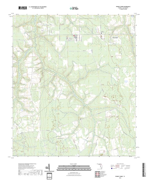
2024 Map of Penney Farms
USGS Topo · Published 2024About this map
Penney Farms serves as the focal point of this Clay County landscape, where the planned street grid of the town center contrasts with the meandering drainage systems of the Florida interior. The hydrologic network is defined by the South Fork Black Creek in the northwest and Peters Creek to the east, with Greens Creek cutting through the central woodland. Local history and genealogy are anchored by sites such as the Penney Farms Cem and Salem Cem, alongside the enigmatic Pass Station near the eastern boundary. The road network, including Co RD 218 and Co RD 315, connects residential areas like Seamark Ranch RD to the more remote timberlands and wetlands characteristic of the region. This survey captures a rural landscape where established agricultural footprints meet a growing network of named residential lanes and connectors.
Find a feature on this map
46 named features on this map. Tap any name to fly to it.
Don’t see what you’re looking for? This feature index may not catch every label — zoom into the map to look around manually.
Map Details
Editions of this 2024 Penney Farms Map
This is the sole edition of this map. No revisions or reprints were ever made.
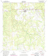
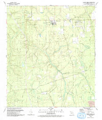
Historical Maps of Penney Farms Through Time
3 maps found