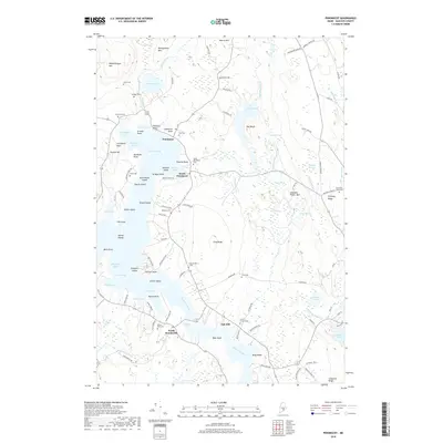
2018 Map of Penobscot
USGS Topo · Published 2018About this map
Northern Bay and the tidal reaches of the Bagaduce River define this coastal landscape on the Maine shore. The 2018 survey reveals a settlement pattern anchored by Penobscot, South Penobscot, and North Brooksville, with numerous small family cemeteries like Leach Cem, Hutchins Cem, and Westcott Cem scattered throughout the hills. The terrain is marked by distinctive elevations such as Wallamatogus Mtn and Gray Ridge, while the shoreline is a complex network of points and coves, including Grindle Point and Tapley Cove.
Find a feature on this map
116 named features on this map. Tap any name to fly to it.
Don’t see what you’re looking for? This feature index may not catch every label — zoom into the map to look around manually.
Map Details
Editions of this 2018 Penobscot Map
This is the sole edition of this map. No revisions or reprints were ever made.
Other maps of this area

1900 · Orland
USGS Topo · 1:62,500

1900 · Bucksport
USGS Topo · 1:62,500

1902 · Bucksport
USGS Topo · 1:62,500

1902 · Castine
USGS Topo · 1:62,500

1904 · Castine
USGS Topo · 1:62,500

1904 · Bluehill
USGS Topo · 1:62,500

1905 · Penobscot Bay
USGS Topo · 1:125,000

1941 · Castine
USGS Topo · 1:62,500

1942 · Orland
USGS Topo · 1:62,500

1942 · Bucksport
USGS Topo · 1:62,500