2022 Map of Pepin
USGS Topo · Published 2022About this map
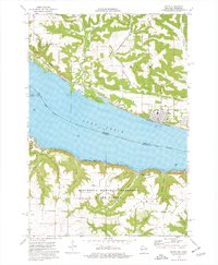
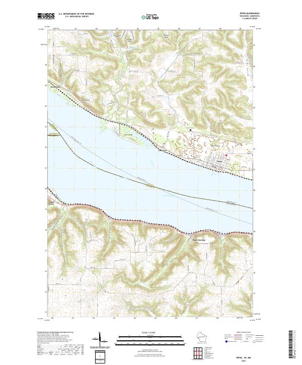
Mississippi River creates a dramatic boundary on this sheet, widening into the expansive Lake Pepin between Wisconsin and Minnesota. The riverfront is anchored by the historic village of Pepin, situated on the fertile Pepin Prairie, while the small community of Stockholm sits to the northwest near the base of Bogus Bluff. This landscape is defined by the contrast between the flat river valley and the deeply dissected uplands of the driftless area, where a series of steep coulees like Riley Coulee and Kepler Coulee drain toward the water. On the Minnesota shore, the city of Lake City overlooks the widening channel, with the rugged Rattlesnake Hill rising nearby. Small aviation facilities like the Bogus Creek Airport and Airwolfe Airport occupy the level plateaus above the bluffs, while local history is marked by the Oakwood Cem and the river-fronting settlement of Lakeport.
Find a feature on this map
49 named features on this map. Tap any name to fly to it.
Don’t see what you’re looking for? This feature index may not catch every label — zoom into the map to look around manually.
Map Details
Editions of this 2022 Pepin Map
This is the sole edition of this map. No revisions or reprints were ever made.