
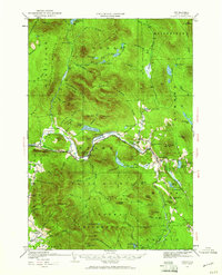
1930 Map of Percy
USGS Topo · Published 1987About this map
The Upper Ammonoosuc River carves a narrow corridor through the high terrain of Coos County, defining the settlement patterns of Stark and Percy during the early twentieth century. This 1930 survey highlights the critical role of the Grand Trunk railway, which follows the riverbank to connect these isolated mountain communities. The landscape is dominated by the massive presence of the White Mountain National Forest, where features like the Devils Slide and Mill Mtn loom over the valley floor. To the east, West Milan serves as a hub near the Grand Trunk Branch, surrounded by family-named landmarks such as Bickford Hill and Cummings Mtn. This map captures a transition in land use, showing established district schools like Emerson Sch and Blake Sch alongside the US Fish Hatchery and the remote outpost of No 8 Camp, illustrating the blend of timber industry, government conservation, and small-town New Hampshire life.
Find a feature on this map
109 named features on this map. Tap any name to fly to it.
Don’t see what you’re looking for? This feature index may not catch every label — zoom into the map to look around manually.
Map Details
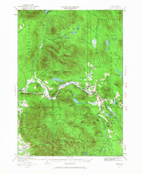
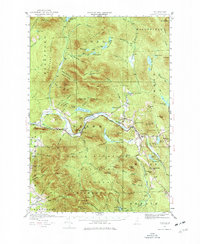
Editions of this 1930 Percy Map
5 editions found
Other maps of this area

1893 · Mt. Washington
USGS Topo · 1:62,500

1893 · Gorham
USGS Topo · 1:62,500

1896 · Mt. Washington
USGS Topo · 1:62,500

1896 · Gorham
USGS Topo · 1:62,500

1900 · Whitefield
USGS Topo · 1:62,500

1920 · Guildhall
USGS Topo · 1:62,500

1929 · Averill
USGS Topo · 1:62,500

1930 · Milan
USGS Topo · 1:62,500

1930 · Percy
USGS Topo · 1:62,500

1930 · Dixville
USGS Topo · 1:62,500