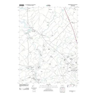
2010 Map of Perkiomenville
USGS Topo · Published 2010About this map
Perkiomen Creek and its many branches form the backbone of this Montgomery County landscape, where traditional rural hamlets meet growing residential estates. The map reveals a dense network of local-history landmarks, particularly concentrated around old crossroads like Sumneytown and Perkiomenville. Genealogists will find a wealth of specific burial grounds, including the Old Goshenhoppen Cemetery and the Christ Evangelical Congregation Cemetery in Zieglersville. The transition from the area's agricultural past to modern development is visible in the mix of legacy farms and newer subdivisions like Village Brook Estate and The Heathers. Public and recreation spaces are prominent, from the expansive Green Lane Reservoir in the northwest to the Governor Pennypacker Monument in the south. Several small aviation fields, such as Godshalls Airport and Shontz Airport, are also documented, alongside specialized institutions like the Hart Scout Camp and the New Life Boys Ranch.
Find a feature on this map
179 named features on this map. Tap any name to fly to it.
Don’t see what you’re looking for? This feature index may not catch every label — zoom into the map to look around manually.
Map Details
Editions of this 2010 Perkiomenville Map
This is the sole edition of this map. No revisions or reprints were ever made.
Other maps of this area

1888 · Quakertown
USGS Topo · 1:62,500

1890 · Quakertown
USGS Topo · 1:62,500

1894 · Quakertown
USGS Topo · 1:62,500

1894 · Norristown
USGS Topo · 1:62,500

1895 · Norristown
USGS Topo · 1:62,500

1896 · Norristown
USGS Topo · 1:62,500

1902 · Boyertown
USGS Topo · 1:62,500

1906 · Phoenixville
USGS Topo · 1:62,500

1942 · Norristown
USGS Topo · 1:125,000
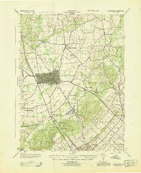
1943 · Quakertown
USGS Topo · 1:31,680
Featured Places
- Limerick Township, PA
- Skippack Township, PA
- Franconia Township, PA
- Harleysville, Lower Salford Township
- New Hanover Township, PA