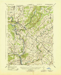
1943 Map of Perkiomenville
USGS Topo · Published 1943About this map
Perkiomen Creek defines the winding geography of this Montgomery County landscape, its path carving through the hills of Upper Frederick and Lower Frederick. During the early 1940s, the region maintained a pattern of scattered villages and crossroads hamlets connected by the Reading line. This railroad presence was central to the development of Perkiomenville and Schwenksville, serving as a vital link for the agricultural and early industrial communities along the valley. Notable elevations such as Spring Mtn and Deep Ridge rise above the waterway, framing the numerous tributaries like Macoby Creek and Unami Creek. The map documents the intricate network of local townships, from Marlboro to Franconia, showing the location of family-named landmarks such as Shirks Corner and established settlements like Harleysville and Salfordville before modern suburban expansion significantly altered the rural character of the Perkiomen Valley.
Find a feature on this map
43 named features on this map. Tap any name to fly to it.
Don’t see what you’re looking for? This feature index may not catch every label — zoom into the map to look around manually.
Map Details
Editions of this 1943 Perkiomenville Map
This is the sole edition of this map. No revisions or reprints were ever made.
Other maps of this area

1888 · Quakertown
USGS Topo · 1:62,500

1890 · Quakertown
USGS Topo · 1:62,500

1894 · Quakertown
USGS Topo · 1:62,500

1894 · Norristown
USGS Topo · 1:62,500

1895 · Norristown
USGS Topo · 1:62,500

1896 · Norristown
USGS Topo · 1:62,500

1902 · Boyertown
USGS Topo · 1:62,500

1906 · Phoenixville
USGS Topo · 1:62,500

1942 · Norristown
USGS Topo · 1:125,000
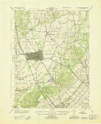
1943 · Quakertown
USGS Topo · 1:31,680
Featured Places
- Limerick Township, PA
- Skippack Township, PA
- Franconia Township, PA
- Harleysville, Lower Salford Township
- New Hanover Township, PA