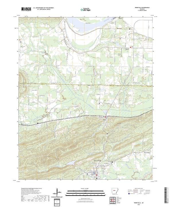
2024 Map of Perryville
USGS Topo · Published 2024About this map
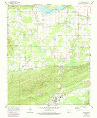
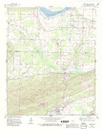
The Perryville and Perry communities anchor this landscape where the central Arkansas lowlands meet the rising elevations of Petit Jean Mountain and Rose Creek Mountain. At the heart of the settlement is the Perry County Courthouse, surrounded by the local educational and spiritual centers of Perryville High School and the Perryville United Methodist Church. The geography is defined by complex water systems, from the broad Arkansas River and Willow Bend in the north to the winding Fourche LaFave River and its Steamboat Foot in the south. Genealogists will find a wealth of burial sites across the township, including the Ada Valley Cem, Stover Cem, and Harper Cem. The transition from river valley to upland is marked by landmarks like Fourche Pinnacle and the Timberlake Reservoir, illustrating a landscape shaped by both natural drainage and local infrastructure.
Find a feature on this map
119 named features on this map. Tap any name to fly to it.
Don’t see what you’re looking for? This feature index may not catch every label — zoom into the map to look around manually.
Map Details
Editions of this 2024 Perryville Map
This is the sole edition of this map. No revisions or reprints were ever made.
Historical Maps of Rehms Corner Through Time
3 maps found