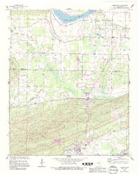
1989 Map of Perryville
USGS Topo · Published 1995About this map
Perryville and the surrounding river bottomlands are captured here in a period of late 20th-century revision, showing the transition from the rugged highlands of Perry Mountain to the agricultural plains of Ada Valley. The landscape is anchored by the Arkansas River to the north and the Fourche La Fave River to the south, with the significant Lock and Dam No 9 regulating the northern waterway near Riverview.
Find a feature on this map
41 named features on this map. Tap any name to fly to it.
Don’t see what you’re looking for? This feature index may not catch every label — zoom into the map to look around manually.
Map Details
Editions of this 1989 Perryville Map
This is the sole edition of this map. No revisions or reprints were ever made.
Other maps of this area

1889 · Morrilton No. 3
USGS Topo · 1:62,500

1890 · Benton
USGS Topo · 1:125,000

1892 · Morrillton
USGS Topo · 1:125,000

1894 · Morrillton
USGS Topo · 1:125,000

1894 · Benton
USGS Topo · 1:125,000

1955 · Little Rock
USGS Topo · 1:250,000

1956 · Little Rock
USGS Topo · 1:250,000

1956 · Russellville
USGS Topo · 1:250,000

1960 · Little Rock
USGS Topo · 1:250,000

1961 · Perryville
USGS Topo · 1:24,000