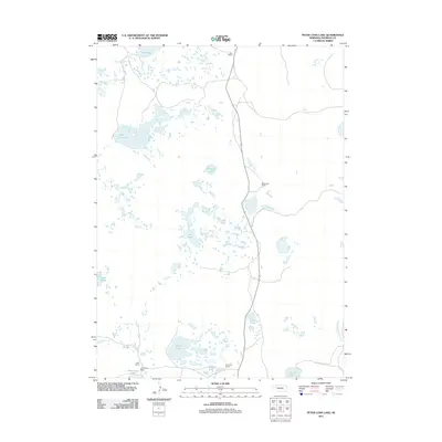
2011 Map of Peter Long Lake
USGS Topo · Published 2011About this map
Joy Ranch and Panhandle Ranch anchor this portion of the Nebraska Sandhills in Sheridan County, illustrating the enduring cattle-ranching heritage of the region. The landscape is defined by a dense network of wind-formed depressions and alkali lakes, including the prominent Peter Long Lake and Potmesil Lake. These water bodies are vital landmarks in a semi-arid environment where family-named properties like the Cody Ranch, John Cody Ranch, and Arapahoe Ranch speak to the history of local land ownership.
Find a feature on this map
14 named features on this map. Tap any name to fly to it.
Don’t see what you’re looking for? This feature index may not catch every label — zoom into the map to look around manually.
Map Details
Editions of this 2011 Peter Long Lake Map
This is the sole edition of this map. No revisions or reprints were ever made.
Other maps of this area

1948 · Antioch
USGS Topo · 1:62,500

1948 · Lakeside
USGS Topo · 1:62,500

1948 · Twin Lakes
USGS Topo · 1:62,500

1949 · Antioch
USGS Topo · 1:62,500

1950 · Twin Lakes
USGS Topo · 1:62,500

1950 · Lakeside
USGS Topo · 1:62,500

1950 · Skunk Lake
USGS Topo · 1:62,500

1955 · Alliance
USGS Topo · 1:250,000

1957 · Alliance
USGS Topo · 1:250,000

1958 · Alliance
USGS Topo · 1:250,000