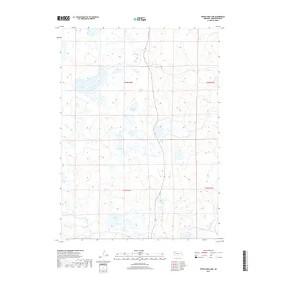
2017 Map of Peter Long Lake
USGS Topo · Published 2017About this map
The interdunal wetlands and lakes of the Nebraska Sandhills define this section of Sheridan County, where numerous small bodies of water are distributed across a complex landscape of ridges and depressions. Peter Long Lake stands out as a prominent water feature in the northwest, while others like Potmesil Lake and Nye Lake are scattered through the central portions of the survey. The geography reflects the high-plains ranching environment of the Cody Ranch area, where travel is facilitated by local tracks such as 251 Trl and 183rd Trl. This 2017 study illustrates the delicate hydrology of the region, including smaller groups of water like Hughes Lakes and southern features such as Simondson Lake and Dennis Lake. The map provides a detailed view of the township and range lines, including t26n r44w, which organize the remote, open country of northwestern Nebraska.
Find a feature on this map
14 named features on this map. Tap any name to fly to it.
Don’t see what you’re looking for? This feature index may not catch every label — zoom into the map to look around manually.
Map Details
Editions of this 2017 Peter Long Lake Map
This is the sole edition of this map. No revisions or reprints were ever made.
Other maps of this area

1948 · Antioch
USGS Topo · 1:62,500

1948 · Lakeside
USGS Topo · 1:62,500

1948 · Twin Lakes
USGS Topo · 1:62,500

1949 · Antioch
USGS Topo · 1:62,500

1950 · Twin Lakes
USGS Topo · 1:62,500

1950 · Lakeside
USGS Topo · 1:62,500

1950 · Skunk Lake
USGS Topo · 1:62,500

1955 · Alliance
USGS Topo · 1:250,000

1957 · Alliance
USGS Topo · 1:250,000

1958 · Alliance
USGS Topo · 1:250,000