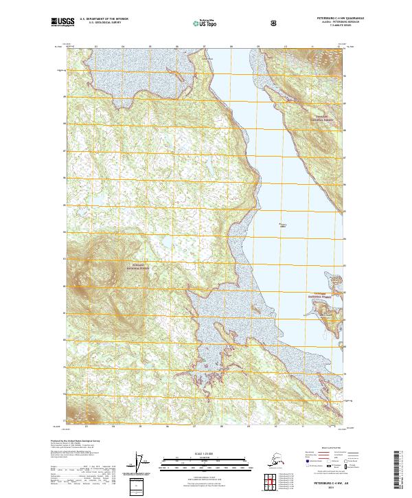
2021 Map of Petersburg C-4 NW
USGS Topo · Published 2021About this map
Tongass National Forest dominates this coastal landscape, where the tides of the Alexander Archipelago meet the complex hydrology of the Alaska Panhandle. The waterway of Mitchell Tonka and the flows of Brown Creek define the northeastern corridor, while the lower reaches of the Castle River transition into a fractured coastline. This 2021 survey reveals a landscape largely shaped by its marine environment, featuring prominent landmarks such as Indian Point and a series of navigational features including Rookery Island, High Castle Island, and Big Castle Island. The presence of the Mitchell-Tonka road provides one of the few terrestrial points of access in an area otherwise characterized by its intricate shoreline and heavily forested interior. The map serves as a contemporary record of the shifting wetland boundaries and topographic contours of this protected wilderness area within the Petersburg Borough.
Find a feature on this map
13 named features on this map. Tap any name to fly to it.
Don’t see what you’re looking for? This feature index may not catch every label — zoom into the map to look around manually.
Map Details
Editions of this 2021 Petersburg C-4 NW Map
This is the sole edition of this map. No revisions or reprints were ever made.
Other maps of this area

1948 · Petersburg C-4
USGS Topo · 1:63,360

1948 · Petersburg C-5
USGS Topo · 1:63,360

1948 · Petersburg D-5
USGS Topo · 1:63,360

1951 · Petersburg D-4
USGS Topo · 1:63,360

1951 · Petersburg C-4
USGS Topo · 1:63,360

1951 · Petersburg C-5
USGS Topo · 1:63,360

1952 · Petersburg
USGS Topo · 1:250,000

1960 · Petersburg
USGS Topo · 1:250,000
1992 · Petersburg D-4 SE
USGS Topo · 1:25,000
1995 · Petersburg C-4
USGS Topo · 1:63,360