Old Maps of Petersburg Borough, Alaska
Explore 378 old maps of Petersburg Borough, spanning from 1943 to today. These high-resolution historic maps reveal how streets, neighborhoods, landmarks, and natural features evolved over time — perfect for genealogy, metal detecting, research, and local history exploration.
What you can do with these maps:
- See how Petersburg Borough changed over time: Compare historical maps to modern-day views to trace roads, homesites, rail lines & more.
- View detailed metadata: Each map includes creators, publishers, year, scale, and archive source.
- Overlay maps with satellite & LiDAR: Visualize the past alongside modern tools to explore terrain & human change.
- Trusted historical sources: Maps sourced from the USGS, Library of Congress, and other archives.
- Access maps your way: View online, download high-res files, or order prints for personal or research use.
Start exploring old maps of Petersburg Borough to uncover forgotten places, hidden landmarks, and the deep history beneath your feet.
Petersburg Borough, AK maps
(378)- 1943 Map of Sumdum B-4, 1979 Print
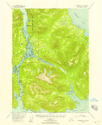
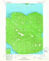
 1943 Sumdum B-41979 Print · USGSSoutheastern Alaska's intricate coastline is documented here during the mid-century, featuring the deep waters of Port Houghton. Researchers can locate the Walter Island Cabin and trace the drainage of the Chuck River into The Salt Chuck.
 - 1948 Map of Sumdum A-4, 1957 Print
 1948 Sumdum A-41957 Print · USGSThe coastal wilderness of Southeast Alaska is documented here just after the war. Researchers can trace early maritime landmarks like Francis Anchorage and remote outposts such as the Cabins along the Farragut River.
 - 1948 Map of Port Alexander C-1, 1957 Print
 1948 Port Alexander C-11957 Print · USGSKuiu Island in the years following World War II reveals a landscape of isolated coastal industry and deep wilderness. Researchers can trace the maritime footprint of the Pillar Bay Cannery and locate remote outposts like Beck and Ben.
 - 1948 Map of Petersburg A-6, 1957 Print
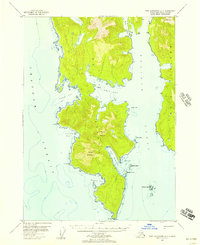
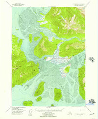
 1948 Petersburg A-61957 Print · USGSThe maritime wilderness of Southeast Alaska is documented here in the late 1940s, centering on the waters of Sumner Strait. Researchers can trace the rugged coastlines of Kuiu Island and Kosciusko Island, locating specific landmarks like Ruins Pt and Pt St Albans.
 - 1948 Map of Port Alexander A-1, 1957 Print
 1948 Port Alexander A-11957 Print · USGSSoutheast Alaska's southern Kuiu Island is captured here in the late 1940s, showing the complex coastline before modern development. Researchers can trace the maritime hazards around the Lighthouse at Cape Decision or the sheltered waters of Port McArthur and Table Bay.3 unique versions available
 - 1948 Map of Sumdum A-5, 1957 Print
 1948 Sumdum A-51957 Print · USGSSoutheast Alaska’s coastal wilderness comes into focus in the late 1940s at the meeting of Stephens Passage and Frederick Sound. Researchers can trace the remnants of local industry at the Cannery (Aban'd) and locate isolated Cabins near Cape Fanshaw.3 unique versions available
 - 1948 Map of Petersburg C-4, 1957 Print
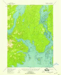
 1948 Petersburg C-41957 Print · USGSSoutheastern Alaska in the late 1940s remained a maritime frontier where life centered on the protected waters of Duncan Canal. Genealogists and historians can trace old Cabin locations and coastal landmarks like Big Saltery Island, Beecher Pass, and Kah Sheets Lake.
 - 1948 Map of Petersburg B-6, 1957 Print
 1948 Petersburg B-61957 Print · USGSSoutheast Alaska’s maritime frontier is detailed here in the late 1940s, documenting the rugged coastline of Kuiu Island and its surrounding straits. Nautical researchers and local historians can trace remote coastal Cabins and vital navigational markers like Beauclerc Light and Strait Island.
 - 1948 Map of Petersburg C-1, 1957 Print
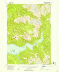
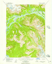 1948 Petersburg C-11957 Print · USGSCoastal Alaska at the end of the 1940s reveals a wilderness of shifting river channels and glacial ice. Trace the braided Stikine River to find Chief Shakes Hot Springs, the Groundhog Basin, and isolated riverside Cabin locations.
 - 1948 Map of Sumdum A-6, 1957 Print
 1948 Sumdum A-61957 Print · USGSKupreanof Island and the surrounding waters of Southeast Alaska are shown here as they appeared in the late 1940s. Researchers can trace the rugged coastline from Pinta Pt to Slate No 2 and locate maritime markers like the Light on Turnabout I.5 unique versions available
 - 1948 Map of Petersburg C-2, 1957 Print
 1948 Petersburg C-21957 Print · USGSSoutheast Alaska’s intricate coastal islands and glacial river deltas are captured here in the late forties. Researchers can locate remote Cabins, maritime markers at Dry Strait East Base, and geological points like Garnet Ledge and Sam Peak.
 - 1948 Map of Port Alexander B-1, 1957 Print
 1948 Port Alexander B-11957 Print · USGSKuiu Island and the surrounding Alexander Archipelago are captured here in the late 1940s, showcasing a wilderness of intricate bays and coastal peaks. Trace the maritime landscape through the sheltered Gedney Harbor, Petrof Bay, and the narrow Helianthus Passage.
 - 1948 Map of Sumdum B-4, 1958 Print
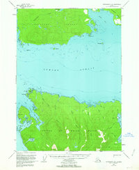
 1948 Sumdum B-41958 Print · USGSThe coastal wilderness of the Tongass National Forest is documented here in the late 1940s, showing a landscape of glacial fjords and steep peaks. You can locate a remote Cabin near Walter Island and trace the reaches of Port Houghton.2 unique versions available
 - 1948 Map of Petersburg D-6, 1958 Print
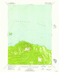
 1948 Petersburg D-61958 Print · USGSKake and the surrounding islands of the Alexander Archipelago are captured here shortly after the war, showing the area's coastal industry and maritime paths. Researchers can trace the Goldstein Trail and locate the historic cannery and Kake settlement.
 - 1948 Map of Port Alexander A-2, 1958 Print
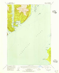
 1948 Port Alexander A-21958 Print · USGSThe southern tip of Baranof Island and the isolated outpost of Port Alexander are captured here in the late forties. Maritime historians and genealogists can trace the waterfront settlement, the local Cem, and landmarks like Cape Ommaney.
 - 1948 Map of Craig D-7 and D-8, 1958 Print
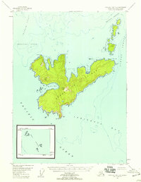 1948 Craig D-7 and D-81958 Print · USGSThe maritime wilderness of Southeast Alaska is recorded here just after the war, centered on Coronation Island. Researchers can trace old navigational markers and remote landforms like Windy Peak, Helm Lt, and the isolated Hazy Islands.3 unique versions available
 - 1948 Map of Port Alexander D-1, 1958 Print
 1948 Port Alexander D-11958 Print · USGSKuiu Island and the surrounding waters of Frederick Sound are captured here during the post-war era of maritime expansion. Researchers can trace historic industrial sites like the Cannery and navigation markers such as Cornwallis Pt Light and the Sachem monument.4 unique versions available
 - 1948 Map of Petersburg C-3, 1958 Print
 1948 Petersburg C-31958 Print · USGSMitkof Island and the Lindenberg Peninsula appear here in the late 1940s, mapped during an era of experimental agriculture and coastal navigation. Researchers can trace maritime landmarks like the Tonka (Aband) dock, the Alaska Experimental Fur Farm, and Hoffman Anchorage.
 - 1948 Map of Petersburg C-6, 1958 Print
 1948 Petersburg C-61958 Print · USGSKuiu and Kupreanof Islands are captured in the late 1940s, showing a roadless wilderness within the Tongass National Forest. Nautical researchers can trace the complex shoreline of Rocky Pass and find remote landmarks like Seclusion Harbor and Devils Elbow.4 unique versions available
 - 1948 Map of Sitka A-1, 1958 Print
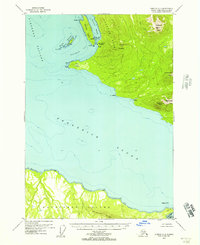
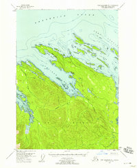
 1948 Sitka A-11958 Print · USGSThe maritime wilderness of Southeast Alaska appears here in the late Forties, centered on the southern tip of Admiralty Island and the waters of Frederick Sound. Researchers can trace old navigational routes through Eliza Harbor and locate early structures like the Cabin at Woewodski Harbor.4 unique versions available
 - 1948 Map of Petersburg C-5, 1958 Print
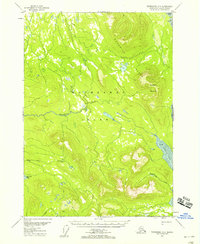
 1948 Petersburg C-51958 Print · USGSKupreanof Island in the late 1940s remains a wilderness of dense forests and complex coastal inlets. Researchers can trace the winding course of the Castle River and the shoreline of Keku Strait within the Tongass National Forest.
 - 1948 Map of Port Alexander B-2, 1958 Print
 1948 Port Alexander B-21958 Print · USGSBaranof Island and the waters of Chatham Strait are captured in the late 1940s, showing the remote maritime outposts of Southeast Alaska. Trace the coastal developments at Port Alexander and Port Armstrong, or find the secluded Cabin near New Port Walter.
 - 1948 Map of Petersburg D-5, 1959 Print
 1948 Petersburg D-51959 Print · USGSKupreanof Island and the coastal reaches of the Tongass National Forest are captured here during the late 1940s. Researchers can trace the drainages of Hamilton Creek and Big John Creek or locate landmarks like Kupreanof Mountain.3 unique versions available
 - 1948 Map of Petersburg B-3, 1966 Print
 1948 Petersburg B-31966 Print · USGSZarembo Island and its surrounding channels appear here in the late 1940s as a largely untouched expanse of the Alexander Archipelago. Researchers can trace the wild coastal perimeter from St John Harbor to the waters of Meter Bight and Baht Harbor.3 unique versions available
 - 1949 Map of Petersburg B-5, 1963 Print
 1949 Petersburg B-51963 Print · USGSPrince of Wales and Kupreanof Islands are shown in the mid-twentieth century as maritime life centers on these intricate straits. Trace old coastal activity at the Trading Post near Point Baker and explore the waters of Port Protection.3 unique versions available
Showing maps 1-25 of 378
Top cities of Petersburg Borough
- Petersburg historical maps
- Kake historical maps
- Port Alexander historical maps
- Kupreanof historical maps
Frequently asked questions
- What are the different types of historical maps available for Petersburg Borough?
- What is the oldest map of Petersburg Borough?
- Where can I purchase historical maps of Petersburg Borough for my home or office?
- Where can I download high-res historical maps of Petersburg Borough?
- Are there historical topographic maps available for Petersburg Borough?
- Is there historical aerial imagery available for Petersburg Borough?
- Where are historical maps of Petersburg Borough sourced from?