1960s Maps of Petersburg Borough, Alaska
Explore 12 historic maps of Petersburg Borough from the 1960s. These maps offer a rare glimpse into what life looked like during the 1960s — showing old roads, neighborhoods, homes, and landmarks that have changed or disappeared over time.
Whether you're researching your family's past, planning a metal detecting trip, or studying how Petersburg Borough's landscape evolved across the 1960s, these high-resolution maps are a powerful tool for exploring the history of this region.
- Focus on a specific era: All maps on this page are from the 1960s, giving you a focused view of this time period.
- See what’s changed: Compare century-old streets, trails, and buildings to today's modern landscape using overlays and satellite layers.
- Research with precision: Use these maps for genealogy, historical research, land use analysis, or educational projects.
- View, download, or print: Maps are fully viewable online in high resolution, and can be downloaded or printed for your own records.
Start exploring Petersburg Borough's history through authentic maps from the 1960s. This is your window into the past.
Petersburg Borough, AK maps
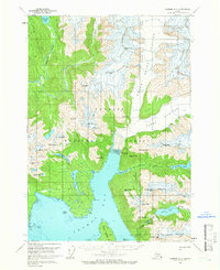
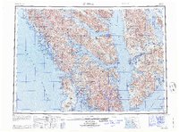
(12)- 1960 Map of Petersburg, 1966 Print
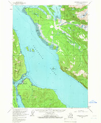
 1960 Petersburg1966 Print · USGSSoutheast Alaska's maritime landscape is captured here in the mid-1900s, showcasing the intricate island networks of the Alexander Archipelago. Researchers can trace historic shorelines and island settlements from Petersburg and Kake to the Wrangell Cemetery and the Stikine River.3 unique versions available
 - 1960 Map of Sumdum A-1, 1966 Print
 1960 Sumdum A-11966 Print · USGSThe high peaks and ice fields of the Stikine region are captured here in the early sixties, marking the international frontier. Researchers can trace the massive Le Conte Glacier and find prominent boundary markers like Kates Needle and Mount Burkett.2 unique versions available
 - 1961 Map of Sumdum A-2, 1966 Print
 1961 Sumdum A-21966 Print · USGSThe high ice fields of the Alaska-Canada border are frozen in time on this 1960s survey. Researchers can trace the massive Baird Glacier, identify landmarks like Devils Thumb, and explore the drainages of Scenery Creek.2 unique versions available
 - 1961 Map of Sumdum B-2, 1966 Print
 1961 Sumdum B-21966 Print · USGSThe high Boundary Range along the Alaska-Canada border is captured here in the early sixties, showing a landscape defined by massive ice fields. Researchers can trace the international boundary across Dawes Glacier and locate peaks like Boundary Peak 74.2 unique versions available
 - 1961 Map of Petersburg D-3, 1966 Print
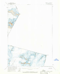
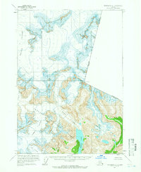
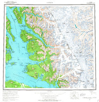
 1961 Petersburg D-31966 Print · USGSSoutheast Alaska at the start of the 1960s centers on the bustling maritime hub of Petersburg along the Wrangell Narrows. Researchers can trace the waterfront infrastructure of the era, from the Seaplane Airport to the outlying settlements of West Petersburg and Doyhof.3 unique versions available
 - 1961 Map of Sumdum A-3, 1966 Print
 1961 Sumdum A-31966 Print · USGSSoutheast Alaska’s glacial coastline appears in sharp detail during the early 1960s, centered on the deep waters of Thomas Bay. Researchers can trace the reach of the Baird Glacier or locate the solitary Cabin along the Farragut River.3 unique versions available
 - 1961 Map of Petersburg D-1, 1966 Print
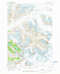
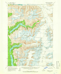
 1961 Petersburg D-11966 Print · USGSSoutheast Alaska's glacial wilderness is documented here in the early sixties as it meets the Canadian border. Researchers can trace the vast ice fields of Le Conte Glacier and the Shakes Glacier near peaks like Castle Mountain.3 unique versions available
 - 1961 Map of Sumdum B-3, 1966 Print
 1961 Sumdum B-31966 Print · USGSSoutheast Alaska’s glacial wilderness is captured here in the early years of statehood, showing the massive ice sheets before modern recession. Researchers can trace the extent of Dawes Glacier and locate landmarks like Maury Peak and Glory Lake.2 unique versions available
 - 1961 Map of Petersburg D-2, 1966 Print
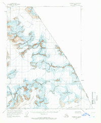
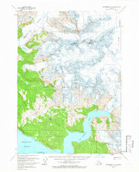 1961 Petersburg D-21966 Print · USGSSoutheast Alaska’s glacial coastline appears in sharp detail during the early 1960s, showing the intersection of ice and sea. Researchers can locate remote shoreline Cabin sites and trace the massive flow of Patterson Glacier and Le Conte Glacier.3 unique versions available
 - 1961 Map of Sumdum, 1967 Print
 1961 Sumdum1967 Print · USGSThe coastal wilderness of Southeast Alaska is captured here in the mid-twentieth century, showing a landscape defined by deep fjords and isolated maritime outposts. Researchers can trace early settlements and navigation aids like Windham, Jamestown, and the Five Finger Lighthouse.2 unique versions available
 - 1964 Map of Sitka
 1964 Sitka1964 Print · USGSSoutheast Alaska's rugged archipelago is captured in the mid-twentieth century as maritime commerce and coastal outposts shaped the region. Genealogists and historians can trace established settlements like Sitka and Angoon or vanished points such as Gypsum and Manleyville.
 - 1964 Map of Port Alexander
 1964 Port Alexander1964 Print · USGSSoutheast Alaska in the mid-1960s was a landscape of remote coastal outposts and cannery towns connected by the sea. Trace the maritime history of the Alexander Archipelago through sites like Goddard, the Pillar Bay Cannery, and the isolated Lighthouse at Cape Decision.
End of results
Showing maps 1-12 of 12
Top cities of Petersburg Borough
- Petersburg historical maps
- Kake historical maps
- Port Alexander historical maps
- Kupreanof historical maps
Frequently asked questions
- What are the different types of historical maps available for Petersburg Borough?
- What is the oldest map of Petersburg Borough?
- Where can I purchase historical maps of Petersburg Borough for my home or office?
- Where can I download high-res historical maps of Petersburg Borough?
- Are there historical topographic maps available for Petersburg Borough?
- Is there historical aerial imagery available for Petersburg Borough?
- Where are historical maps of Petersburg Borough sourced from?