1950s Maps of Petersburg Borough, Alaska
Explore 28 historic maps of Petersburg Borough from the 1950s. These maps offer a rare glimpse into what life looked like during the 1950s — showing old roads, neighborhoods, homes, and landmarks that have changed or disappeared over time.
Whether you're researching your family's past, planning a metal detecting trip, or studying how Petersburg Borough's landscape evolved across the 1950s, these high-resolution maps are a powerful tool for exploring the history of this region.
- Focus on a specific era: All maps on this page are from the 1950s, giving you a focused view of this time period.
- See what’s changed: Compare century-old streets, trails, and buildings to today's modern landscape using overlays and satellite layers.
- Research with precision: Use these maps for genealogy, historical research, land use analysis, or educational projects.
- View, download, or print: Maps are fully viewable online in high resolution, and can be downloaded or printed for your own records.
Start exploring Petersburg Borough's history through authentic maps from the 1950s. This is your window into the past.
Petersburg Borough, AK maps
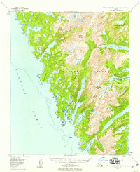
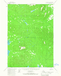
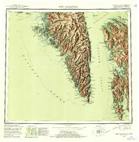
(28)- 1951 Map of Craig D-6, 1952 Print
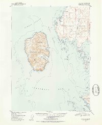 1951 Craig D-61952 Print · USGSCoastal Prince of Wales Island comes alive in the early fifties, showing the maritime isolation of the Alexander Archipelago. Trace the locations of early outposts at Cape Pole and remote Cabin sites near Halibut Harbor and Warren Cove.4 unique versions available
 - 1951 Map of Petersburg B-4, 1954 Print
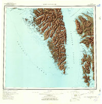
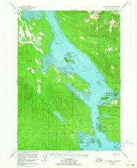
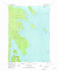
 1951 Petersburg B-41954 Print · USGSSoutheast Alaska’s maritime corridors are documented here in the early fifties, focusing on the junction of Sumner Strait and Clarence Strait. Researchers can trace old navigation aids like The Eye Opener Light and explore coastal features from Red Bay to the Bushy Islands.2 unique versions available
 - 1951 Map of Petersburg B-3, 1954 Print
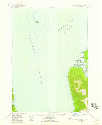
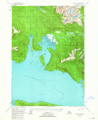
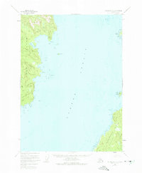
 1951 Petersburg B-31954 Print · USGSZarembo Island and the surrounding waterways of Southeast Alaska appear here in the early fifties. Maritime researchers and historians can trace the intricate shoreline from St John Harbor to Meter Bight and identify landmarks like Pt Howe and Station Island.2 unique versions available
 - 1951 Map of Petersburg D-4, 1958 Print
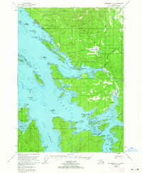
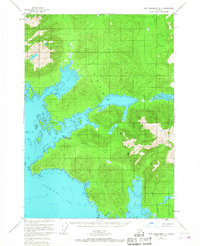
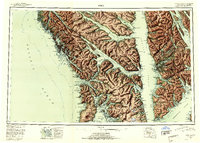
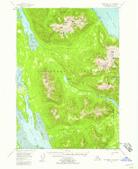 1951 Petersburg D-41958 Print · USGSKupreanof Island and the Lindenberg Peninsula are shown in the early 1950s when the wilderness was navigated by water and forest trail. Researchers can trace the Petersburg Trail past Petersburg Lake or locate isolated cabins along Petersburg Creek.4 unique versions available
 - 1951 Map of Sitka, 1958 Print
 1951 Sitka1958 Print · USGSSoutheast Alaska in the early fifties reveals a landscape defined by water and remote coastal outposts. Genealogists and historians can trace established settlements like Sitka and Angoon alongside industrial markers like a Logging Camp and the Old Sitka ruins.6 unique versions available
 - 1951 Map of Port Alexander C-2, 1958 Print
 1951 Port Alexander C-21958 Print · USGSThe coastal wilderness of Baranof and Kuiu Islands is documented here in the early fifties, highlighting the region's remote maritime industry. Researchers can locate the Herring Reduction Plant at Washington Bay or trace the steep shorelines of Gut Bay and Lords Pocket.3 unique versions available
 - 1951 Map of Port Alexander B-3 and B-4, 1959 Print
 1951 Port Alexander B-3 and B-41959 Print · USGSSoutheast Alaska in the early fifties reveals a landscape of isolated maritime outposts and high alpine lakes on the southern reaches of Baranof Island. Researchers can trace the layout of Big Port Walter and Port Armstrong or locate remote landmarks like the Cabin near Sashin Lake.3 unique versions available
 - 1951 Map of Port Alexander, 1959 Print
 1951 Port Alexander1959 Print · USGSSoutheast Alaska in the early fifties shows a rugged maritime landscape defined by isolated fishing outposts and steep coastal mountains. Trace the locations of historic settlements like Port Alexander, the Lodge at Crawfish Inlet, and the post office at Goddard (Hot Springs P O).5 unique versions available
 - 1951 Map of Port Alexander D-2, 1959 Print
 1951 Port Alexander D-21959 Print · USGSThe Alexander Archipelago in the early fifties reveals a landscape of maritime outposts and remote island terrain. Researchers can trace small coastal Cabins and navigational landmarks like Security Bay, Cedar Harbor, and the anchorage at Roadstead.3 unique versions available
 - 1951 Map of Petersburg D-6, 1964 Print
 1951 Petersburg D-61964 Print · USGSSoutheast Alaskan island life in the early fifties is defined here by the coastal settlement of Kake and its neighboring waters. Researchers can trace historic paths like the Goldstein Trail and locate early industry at the Cannery on the edge of KUPREANOF ISLAND.3 unique versions available
 - 1951 Map of Petersburg C-4, 1964 Print
 1951 Petersburg C-41964 Print · USGSKupreanof Island and the Lindenberg Peninsula are charted here in the early fifties, showcasing the intricate tidewaters of the Tongass National Forest. Researchers can locate remote sites like Hoagies Hole, the Castle Islands, and solitary cabins near Basin Cove.2 unique versions available
 - 1951 Map of Sumdum A-4, 1964 Print
 1951 Sumdum A-41964 Print · USGSCoastal Alaska in the early fifties reveals a landscape of isolated outposts and maritime landmarks along the Frederick Sound. Researchers can trace the Farragut Foot Trail and locate several remote Cabins and a Cabin along the shores of Farragut Bay.2 unique versions available
 - 1951 Map of Port Alexander B-2, 1965 Print
 1951 Port Alexander B-21965 Print · USGSThe southeastern coast of Baranof Island is documented in the mid-fifties, showing the vital maritime hubs of Port Alexander and Port Walter. Researchers can find the Fisheries Research Station and the site of New Port Walter (ABAND).3 unique versions available
 - 1951 Map of Petersburg C-2, 1965 Print
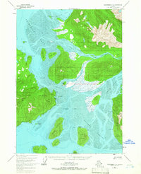 1951 Petersburg C-21965 Print · USGSSoutheastern Alaska's coastal islands and glacial waterways are captured here at mid-century, just as aerial photography began to detail the complex Stikine Delta. Researchers can trace remote outposts like Camp I, mineral sites at Garnet Ledge, and the early Highway route on Mitkof Island.2 unique versions available
 - 1951 Map of Petersburg C-5, 1965 Print
 1951 Petersburg C-51965 Print · USGSKupreanof Island remains a pristine coastal wilderness in the early fifties, situated deep within the Alexander Archipelago. Researchers can trace the wild drainage of Castle River, the secluded Kushneahin Lake, and the shoreline of Totem Bay.3 unique versions available
 - 1951 Map of Port Alexander C-1, 1967 Print
 1951 Port Alexander C-11967 Print · USGSKuiu Island in the early fifties was a hub for the Southeast Alaska fishing industry centered on the Bay of Pillars. Researchers can trace the layout of the Pillar Bay Cannery, the Seaplane Base, and remote sites like Piledriver Cove.3 unique versions available
 - 1951 Map of Petersburg B-6, 1975 Print
 1951 Petersburg B-61975 Print · USGSSoutheast Alaska’s coastal wilderness is frozen in time during the early fifties, showcasing the complex waterways of Kuiu Island. Trace maritime routes and remote outposts like Beauclerc Light, the Cabins on Sumner Island, and the sheltered waters of Alvin Bay.3 unique versions available
 - 1951 Map of Petersburg A-6, 1975 Print
 1951 Petersburg A-61975 Print · USGSSumner Strait and the coastlines of Kuiu and Kosciusko Islands are captured here in the early fifties. Maritime historians can trace coastal landmarks and hazards like Louise Cove, Pt St Albans, and the Barrier Islands.4 unique versions available
 - 1951 Map of Port Alexander A-2, 1975 Print
 1951 Port Alexander A-21975 Print · USGSBaranof Island and the coastal waters of Chatham Strait are documented in the early 1950s, centered on the fishing outpost of Port Alexander. Genealogists and researchers can locate the local Cem and coastal landmarks like Cape Ommaney and Breakfast Rock.
 - 1952 Map of Petersburg, 1953 Print
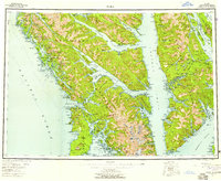
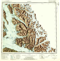
 1952 Petersburg1953 Print · USGSSoutheast Alaska's intricate Alexander Archipelago comes to life in the early fifties, documenting a landscape of remote island settlements and maritime corridors. Genealogists and historians can trace coastal life in Petersburg and Wrangell, or locate early industry at Shakan and regional Mines.5 unique versions available
 - 1952 Map of Port Alexander, 1953 Print
 1952 Port Alexander1953 Print · USGSThe remote coastline of the First Judicial Division is documented here in the early fifties, featuring the isolated outpost of Port Alexander. Researchers can trace the maritime footprint of the era through scattered cabins, the Saginaw Bay Cannery, and the Lighthouse at Cape Decision.4 unique versions available
 - 1952 Map of Sumdum, 1953 Print
 1952 Sumdum1953 Print · USGSSoutheast Alaska in the early fifties was a land of tidewater glaciers and isolated mining outposts. Researchers can trace the layout of remote coastal settlements like Windham and Sumdum or locate the historic Chuck Mining Camp near Endicott Arm.6 unique versions available
 - 1952 Map of Sitka, 1953 Print
 1952 Sitka1953 Print · USGSSoutheast Alaska in the early fifties is mapped here across the islands and straits of the Alexander Archipelago. Researchers can locate coastal outposts like Angoon and Tenakee, or trace the rugged shores of Sitka Sound to the slopes of Mt Edgecumbe.4 unique versions available
 - 1953 Map of Petersburg B-5, 1954 Print
 1953 Petersburg B-51954 Print · USGSThe Alexander Archipelago in the early fifties reveals a landscape of isolated maritime outposts and deep coastal inlets. Researchers can trace the early layout of Point Baker and find historic sites like the Trading Post at Wooden Wheel Cove and Port Protection.2 unique versions available
 - 1953 Map of Petersburg C-1, 1964 Print
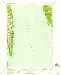
 1953 Petersburg C-11964 Print · USGSThe Stikine River delta was a intricate maze of glacial runoff and tidal sloughs in the early fifties. Researchers can trace the braided channels around Andrew Island, locate the historic Chief Shakes Hot Springs, and identify peaks like Wrangell Peak.3 unique versions available
Showing maps 1-25 of 28
Top cities of Petersburg Borough
- Petersburg historical maps
- Kake historical maps
- Port Alexander historical maps
- Kupreanof historical maps
Frequently asked questions
- What are the different types of historical maps available for Petersburg Borough?
- What is the oldest map of Petersburg Borough?
- Where can I purchase historical maps of Petersburg Borough for my home or office?
- Where can I download high-res historical maps of Petersburg Borough?
- Are there historical topographic maps available for Petersburg Borough?
- Is there historical aerial imagery available for Petersburg Borough?
- Where are historical maps of Petersburg Borough sourced from?