
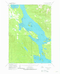
1951 Map of Petersburg C-4
USGS Topo · Published 1964About this map
Duncan Canal defines the central axis of this coastal wilderness, a deep waterway separating the Lindenberg Peninsula from the primary mass of Kupreanof Island. Surveyed in the mid-twentieth century within the Tongass National Forest, the map reveals a landscape defined by tidewater complexity, from the sprawling Tidal Flat at the mouth of Mitchell Slough to the intricate cluster of the Castle Islands.
Find a feature on this map
36 named features on this map. Tap any name to fly to it.
Don’t see what you’re looking for? This feature index may not catch every label — zoom into the map to look around manually.
Map Details
Editions of this 1951 Petersburg C-4 Map
2 editions found
Other maps of this area

1948 · Petersburg C-4
USGS Topo · 1:63,360

1948 · Petersburg C-3
USGS Topo · 1:63,360

1948 · Petersburg C-5
USGS Topo · 1:63,360

1948 · Petersburg D-5
USGS Topo · 1:63,360

1948 · Petersburg B-3
USGS Topo · 1:63,360

1949 · Petersburg B-5
USGS Topo · 1:63,360

1949 · Petersburg B-4
USGS Topo · 1:63,360

1951 · Petersburg B-4
USGS Topo · 1:63,360

1951 · Petersburg B-3
USGS Topo · 1:63,360

1951 · Petersburg D-4
USGS Topo · 1:63,360