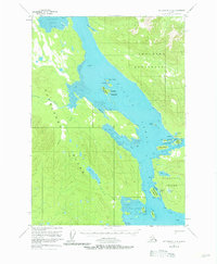
1951 Map of Petersburg C-4
USGS Topo · Published 1981About this map
The waters of Duncan Canal dominate this 1951 topographic study, cleaving the landscape between the Lindenberg Peninsula and Kupreanof Island. This intricate maritime environment is defined by expansive tidal flats and narrow passages, such as Beecher Pass, which separates the mainland from Woewodski Island. The map records a wilderness largely devoid of modern infrastructure, save for an isolated Cabin along the Castle River.
Find a feature on this map
42 named features on this map. Tap any name to fly to it.
Don’t see what you’re looking for? This feature index may not catch every label — zoom into the map to look around manually.
Map Details
Editions of this 1951 Petersburg C-4 Map
2 editions found

Other maps of this area

1948 · Petersburg C-4
USGS Topo · 1:63,360

1948 · Petersburg C-3
USGS Topo · 1:63,360

1948 · Petersburg C-5
USGS Topo · 1:63,360

1948 · Petersburg D-5
USGS Topo · 1:63,360

1948 · Petersburg B-3
USGS Topo · 1:63,360

1949 · Petersburg B-5
USGS Topo · 1:63,360

1949 · Petersburg B-4
USGS Topo · 1:63,360

1951 · Petersburg B-4
USGS Topo · 1:63,360

1951 · Petersburg B-3
USGS Topo · 1:63,360

1951 · Petersburg D-4
USGS Topo · 1:63,360