
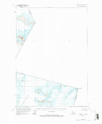
1960 Map of Sumdum A-1
USGS Topo · Published 1966About this map
Le Conte Glacier dominates the southern portion of this high-altitude survey, representing a remote glacial landscape at the international border between Alaska and British Columbia. The terrain is defined by the heavy ice coverage and massive peaks that mark the boundary line, including the formidable Kates Needle on the eastern edge. To the north, the elevation continues to rise through ice fields toward Mount Burkett and Mount T, illustrating the complex glaciology of the Stikine Icefield region during the mid-twentieth century.
Find a feature on this map
6 named features on this map. Tap any name to fly to it.
Don’t see what you’re looking for? This feature index may not catch every label — zoom into the map to look around manually.
Map Details
Editions of this 1960 Sumdum A-1 Map
2 editions found
Other maps of this area

1951 · Bradfield Canal
USGS Topo · 1:250,000

1952 · Petersburg
USGS Topo · 1:250,000

1952 · Sumdum
USGS Topo · 1:250,000

1954 · Bradfield Canal
USGS Topo · 1:250,000

1955 · Bradfield canal D-6
USGS Topo · 1:63,360

1955 · Bradfield Canal
USGS Topo · 1:250,000

1960 · Petersburg
USGS Topo · 1:250,000

1961 · Sumdum A-2
USGS Topo · 1:63,360

1961 · Sumdum B-2
USGS Topo · 1:63,360

1961 · Petersburg D-1
USGS Topo · 1:63,360