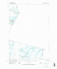
1960 Map of Sumdum A-1
USGS Topo · Published 1983About this map
Le Conte Glacier dominates the southern reaches of this high-altitude survey, illustrating the frozen landscape of the Alaska-Canada boundary during the mid-twentieth century. The international border is defined by prominent peaks including Kates Needle and Mount T, which mark the line between the Alaska territory and British Columbia. The topography is characterized by massive ice fields and dangerous Crevasses, recorded through photogrammetric methods from aerial photography taken in 1948 and 1961. This document serves as a specialized study of the Stikine Icecap region, focusing on the glaciated peaks like Mount Burkett where traditional settlement and road networks are entirely absent. The work was overseen by the International Boundary Commission, reflecting the technical cooperation required to map this extreme environment.
Find a feature on this map
8 named features on this map. Tap any name to fly to it.
Don’t see what you’re looking for? This feature index may not catch every label — zoom into the map to look around manually.
Map Details
Editions of this 1960 Sumdum A-1 Map
2 editions found
Other maps of this area

1951 · Bradfield Canal
USGS Topo · 1:250,000

1952 · Petersburg
USGS Topo · 1:250,000

1952 · Sumdum
USGS Topo · 1:250,000

1954 · Bradfield Canal
USGS Topo · 1:250,000

1955 · Bradfield canal D-6
USGS Topo · 1:63,360

1955 · Bradfield Canal
USGS Topo · 1:250,000

1960 · Petersburg
USGS Topo · 1:250,000

1960 · Sumdum A-1
USGS Topo · 1:63,360

1961 · Sumdum A-2
USGS Topo · 1:63,360

1961 · Sumdum B-2
USGS Topo · 1:63,360