
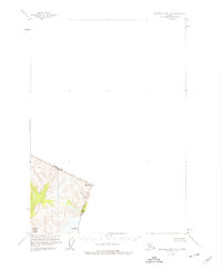
1955 Map of Bradfield canal D-6
USGS Topo · Published 1959About this map
Tongass National Forest covers the terrain of this 1955 survey, where the international boundary between the United States and Canada defines the landscape. The map focuses on the high-altitude peaks and glacial drainages along the British Columbia and Alaska border, specifically marking significant survey points like Mt Gallatin 5098 BP 67 and the triangulation station at VABM Mt Talbot Mon 68 4461.
Find a feature on this map
6 named features on this map. Tap any name to fly to it.
Don’t see what you’re looking for? This feature index may not catch every label — zoom into the map to look around manually.
Map Details
Editions of this 1955 Bradfield canal D-6 Map
2 editions found
Other maps of this area

1948 · Petersburg C-1
USGS Topo · 1:63,360

1951 · Bradfield Canal
USGS Topo · 1:250,000

1952 · Petersburg
USGS Topo · 1:250,000

1952 · Sumdum
USGS Topo · 1:250,000

1953 · Petersburg C-1
USGS Topo · 1:63,360

1954 · Bradfield Canal
USGS Topo · 1:250,000

1955 · Bradfield canal C-6
USGS Topo · 1:63,360
1955 · Bradfield Canal C-5
USGS Topo · 1:63,360

1955 · Bradfield Canal
USGS Topo · 1:250,000

1960 · Petersburg
USGS Topo · 1:250,000