
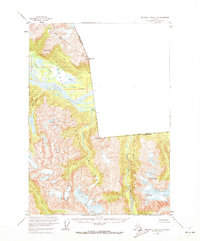
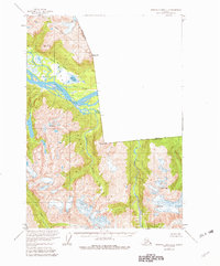
1955 Map of Bradfield canal C-6
USGS Topo · Published 1959About this map
The Stikine River dominates this mid-century Alaskan landscape, its braided channels and vast wetlands forming a complex network of waterways including Ketili Slough, Guerin Slough, and Red Slough. This survey captures the wilderness within the Tongass National Forest shortly after the mid-century, detailing the sharp transition from the river valley floor to high peaks such as Mt Flemer and Black Crag. The map documents the precise international boundary line separating Alaska and British Columbia, as well as the broader Canada-United States border. Local hydrology is remarkably detailed, tracing the winding Ketili River and the West Fork Ketili River as they feed into the larger glacial drainage system near Barnes Lake.
Find a feature on this map
17 named features on this map. Tap any name to fly to it.
Don’t see what you’re looking for? This feature index may not catch every label — zoom into the map to look around manually.
Map Details
Editions of this 1955 Bradfield canal C-6 Map
3 editions found
Other maps of this area

1948 · Petersburg C-1
USGS Topo · 1:63,360

1948 · Petersburg B-1
USGS Topo · 1:63,360

1951 · Bradfield Canal
USGS Topo · 1:250,000

1952 · Petersburg
USGS Topo · 1:250,000

1953 · Petersburg C-1
USGS Topo · 1:63,360

1954 · Bradfield Canal
USGS Topo · 1:250,000

1955 · Bradfield canal B-5
USGS Topo · 1:63,360

1955 · Bradfield canal D-6
USGS Topo · 1:63,360

1955 · Bradfield canal B-6
USGS Topo · 1:63,360
1955 · Bradfield Canal C-5
USGS Topo · 1:63,360