
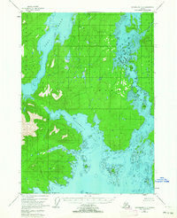
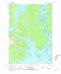
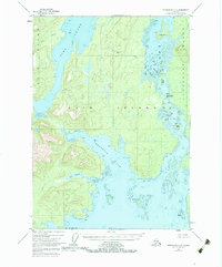
1948 Map of Petersburg C-6
USGS Topo · Published 1958About this map
Kuiu Island and Kupreanof Island dominate this coastal survey, separated by the intricate and islet-choked passage of Rocky Pass. Entirely contained within the Tongass National Forest, the landscape is defined by deep maritime inlets like Port Camden and the elongated Threemile Arm. The topography transitions from these tidewaters to significant elevations such as The Summit, reflecting a wilderness state largely untouched by permanent road infrastructure during the late 1940s. Water-based navigation is the primary focus, with detailed soundings and navigational hazards identified at Devils Elbow and around the numerous small islands like Monte Carlo Island and Eagle Island. The presence of secluded waters like Salt Lagoon and Seclusion Harbor suggests the isolation of the Alexander Archipelago before modern development reached these remote Alaskan shores.
Find a feature on this map
18 named features on this map. Tap any name to fly to it.
Don’t see what you’re looking for? This feature index may not catch every label — zoom into the map to look around manually.
Map Details
Editions of this 1948 Petersburg C-6 Map
4 editions found
Other maps of this area

1948 · Port Alexander C-1
USGS Topo · 1:63,360

1948 · Petersburg B-6
USGS Topo · 1:63,360

1948 · Port Alexander B-1
USGS Topo · 1:63,360

1948 · Petersburg D-6
USGS Topo · 1:63,360

1948 · Port Alexander D-1
USGS Topo · 1:63,360

1948 · Petersburg C-5
USGS Topo · 1:63,360

1948 · Petersburg D-5
USGS Topo · 1:63,360

1949 · Petersburg B-5
USGS Topo · 1:63,360

1951 · Port Alexander
USGS Topo · 1:250,000

1951 · Petersburg D-6
USGS Topo · 1:63,360