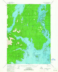
1948 Map of Petersburg C-6
USGS Topo · Published 1963About this map
Kuiu Island and Kupreanof Island dominate this coastal survey, separated by the intricate waterways of the Keeku Strait. This mid-century view within the Tongass National Forest illustrates a complex maritime landscape defined by tidal inlets and narrow channels rather than roads or settlements. The presence of Seclusion Harbor and Salt Lagoon suggests the quiet, protected nature of the western shoreline, while names like Devils Elbow indicate the navigational challenges inherent in the strait. Inland, the topography rises toward The Summit on Summit Island, surrounded by a scatter of smaller landforms including Monte Carlo Island and Eagle Island. This document captures the wilderness character of the Alexander Archipelago before modern development, focusing entirely on the natural hydrography and shoreline features like Three Mile Arm and No Name Bay.
Find a feature on this map
19 named features on this map. Tap any name to fly to it.
Don’t see what you’re looking for? This feature index may not catch every label — zoom into the map to look around manually.
Map Details
Editions of this 1948 Petersburg C-6 Map
4 editions found
Other maps of this area

1948 · Port Alexander C-1
USGS Topo · 1:63,360

1948 · Petersburg B-6
USGS Topo · 1:63,360

1948 · Port Alexander B-1
USGS Topo · 1:63,360

1948 · Petersburg D-6
USGS Topo · 1:63,360

1948 · Port Alexander D-1
USGS Topo · 1:63,360

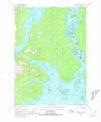
1948 · Petersburg C-6
USGS Topo · 1:63,360

1948 · Petersburg C-5
USGS Topo · 1:63,360

1948 · Petersburg D-5
USGS Topo · 1:63,360

1949 · Petersburg B-5
USGS Topo · 1:63,360

1951 · Port Alexander
USGS Topo · 1:250,000