
1948 Map of Sitka A-1
USGS Topo · Published 1958About this map
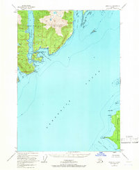
Admiralty Island dominates the northern reaches of this coastal survey, where the deep inlet of Eliza Harbor cuts into the landmass, protected by Liesnoi Island. This mid-century mapping records a maritime landscape defined by complex tidal passages like North Passage and South Passage, which were essential for navigating the inner waters of the Tongass National Forest. Evidence of human activity is sparse but significant, noted by a Cabin on the eastern shore of Woewodski Harbor and another near Pt Macartney Light on Kupreanof Island.
Find a feature on this map
34 named features on this map. Tap any name to fly to it.
Don’t see what you’re looking for? This feature index may not catch every label — zoom into the map to look around manually.
Map Details
Editions of this 1948 Sitka A-1 Map
4 editions found
Other maps of this area

1948 · Sitka B-1
USGS Topo · 1:63,360

1948 · Sitka A-2
USGS Topo · 1:63,360

1948 · Sumdum A-6
USGS Topo · 1:63,360

1948 · Sumdum B-6
USGS Topo · 1:63,360

1948 · Sitka B-2
USGS Topo · 1:63,360

1948 · Petersburg D-6
USGS Topo · 1:63,360

1948 · Port Alexander D-1
USGS Topo · 1:63,360

1951 · Sitka
USGS Topo · 1:250,000

1951 · Port Alexander
USGS Topo · 1:250,000

1951 · Port Alexander D-2
USGS Topo · 1:63,360