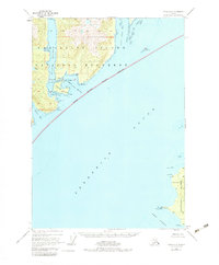
1948 Map of Sitka A-1
USGS Topo · Published 1983About this map
Admiralty Island and its surrounding waterways define this maritime landscape in the years following World War II. The map covers the southeastern reach of the island, much of which is designated as the Admiralty Island National Monument. This area is characterized by a complex network of sheltered anchorages and passages, including Eliza Harbor and Woewodski Harbor, which provided vital refuge for vessels navigating the larger reaches of Frederick Sound.
Find a feature on this map
35 named features on this map. Tap any name to fly to it.
Don’t see what you’re looking for? This feature index may not catch every label — zoom into the map to look around manually.
Map Details
Editions of this 1948 Sitka A-1 Map
4 editions found
Other maps of this area

1948 · Sitka B-1
USGS Topo · 1:63,360

1948 · Sitka A-2
USGS Topo · 1:63,360

1948 · Sumdum A-6
USGS Topo · 1:63,360

1948 · Sumdum B-6
USGS Topo · 1:63,360

1948 · Sitka B-2
USGS Topo · 1:63,360

1948 · Petersburg D-6
USGS Topo · 1:63,360

1948 · Port Alexander D-1
USGS Topo · 1:63,360

1948 · Sitka A-1
USGS Topo · 1:63,360

1951 · Sitka
USGS Topo · 1:250,000

1951 · Port Alexander
USGS Topo · 1:250,000