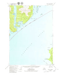
1948 Map of Sitka A-1
USGS Topo · Published 1980About this map
Admiralty Island and the northern tip of Kupreanof Island dominate this coastal survey, where the protected waters of Frederick Sound meet the intricate shorelines of Southeast Alaska. The southern reach of the Admiralty Island National Monument is defined here by an indefinite boundary, encompassing the deep inlet of Eliza Harbor and the remote Eliza Lake. Navigational safety in these complex waterways is marked by landmarks such as Pinta Rks Light and the Pt Macartney Light at the entrance to Keku Strait. A solitary Cabin near Woewodski Harbor and Liesnoi Island suggests the isolated nature of human activity in this landscape at the time of the 1948 aerial survey. The map records a wilderness of named points and passages, including Pt Napean and Chapin Bay, before modern development or intensive road-building reached these island interiors.
Find a feature on this map
40 named features on this map. Tap any name to fly to it.
Don’t see what you’re looking for? This feature index may not catch every label — zoom into the map to look around manually.
Map Details
Editions of this 1948 Sitka A-1 Map
4 editions found
Other maps of this area

1948 · Sitka B-1
USGS Topo · 1:63,360

1948 · Sitka A-2
USGS Topo · 1:63,360

1948 · Sumdum A-6
USGS Topo · 1:63,360

1948 · Sumdum B-6
USGS Topo · 1:63,360

1948 · Sitka B-2
USGS Topo · 1:63,360

1948 · Petersburg D-6
USGS Topo · 1:63,360

1948 · Port Alexander D-1
USGS Topo · 1:63,360

1948 · Sitka A-1
USGS Topo · 1:63,360

1951 · Sitka
USGS Topo · 1:250,000

1951 · Port Alexander
USGS Topo · 1:250,000