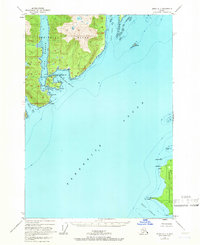
1948 Map of Sitka A-1
USGS Topo · Published 1966About this map
Admiralty Island and the northern tip of Kupreanof Island define this coastal survey, where the waters of Frederick Sound separate these significant landmasses in the Tongass National Forest. The geography is characterized by intricate waterways and sheltered harbors, most notably Eliza Harbor and Woewodski Harbor. Small islands and navigational hazards such as Liesnoi Island and Polynoi Rks are positioned within the straits, marked by the Pinta Rks Light to guide maritime traffic.
Find a feature on this map
34 named features on this map. Tap any name to fly to it.
Don’t see what you’re looking for? This feature index may not catch every label — zoom into the map to look around manually.
Map Details
Editions of this 1948 Sitka A-1 Map
4 editions found
Other maps of this area

1948 · Sitka B-1
USGS Topo · 1:63,360

1948 · Sitka A-2
USGS Topo · 1:63,360

1948 · Sumdum A-6
USGS Topo · 1:63,360

1948 · Sumdum B-6
USGS Topo · 1:63,360

1948 · Sitka B-2
USGS Topo · 1:63,360

1948 · Petersburg D-6
USGS Topo · 1:63,360

1948 · Port Alexander D-1
USGS Topo · 1:63,360

1948 · Sitka A-1
USGS Topo · 1:63,360

1951 · Sitka
USGS Topo · 1:250,000

1951 · Port Alexander
USGS Topo · 1:250,000