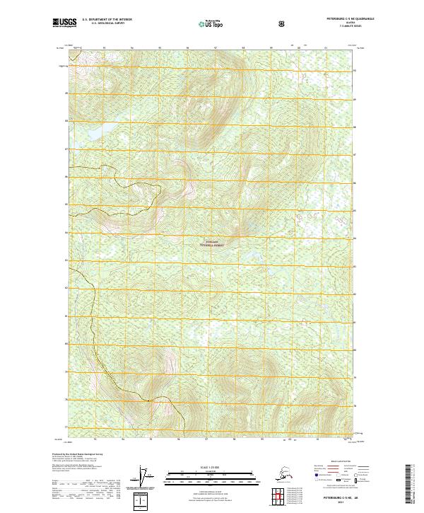
2021 Map of Petersburg C-5 NE
USGS Topo · Published 2021About this map
Tongass National Forest covers the vast majority of this landscape on Kupreanof Island, characterized by a complex network of waterways and timberlands. The coastal boundary along Keku Strait defines the western edge of the quadrangle, where the tidal influence meets the mouths of Keku Cr and Burchard Cr. This 2021 survey illustrates the modern administrative lines of the Petersburg Borough Prince of Wales-Hyder Census Area, showing how civil boundaries are positioned across the wilderness. Inland, the Castle River winds through the interior forest, while the Keku Trail provides one of the few established overland routes through the drainage systems of t59s r76e and the surrounding townships. The map is a detailed record of the hydrological patterns and elevation contours that dictate movement through this southeastern Alaska territory.
Find a feature on this map
11 named features on this map. Tap any name to fly to it.
Don’t see what you’re looking for? This feature index may not catch every label — zoom into the map to look around manually.
Map Details
Editions of this 2021 Petersburg C-5 NE Map
This is the sole edition of this map. No revisions or reprints were ever made.
Other maps of this area

1948 · Petersburg C-4
USGS Topo · 1:63,360

1948 · Petersburg C-5
USGS Topo · 1:63,360

1948 · Petersburg D-5
USGS Topo · 1:63,360

1951 · Petersburg D-4
USGS Topo · 1:63,360

1951 · Petersburg C-4
USGS Topo · 1:63,360

1951 · Petersburg C-5
USGS Topo · 1:63,360

1952 · Petersburg
USGS Topo · 1:250,000

1960 · Petersburg
USGS Topo · 1:250,000
1995 · Petersburg C-4
USGS Topo · 1:63,360
1995 · Petersburg D-4
USGS Topo · 1:63,360