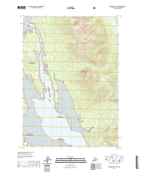
2021 Map of Petersburg D-4 SW
USGS Topo · Published 2021About this map
Tongass National Forest dominates this coastal landscape, where the tides of the North Arm Duncan Canal meet the steep topography of Portage Mtn. The map highlights a significant transition between the marine environment of Duncan Canal and the interior freshwater of Petersburg Lake. Traces of local passage and communication are evident in the south, where the White Alice and White Alice Trl indicate routes near Mitchell Tonka. The presence of these named paths, alongside waterways like Olman Slough and Duncan Cr, illustrates the area's reliance on both riverine and overland travel. From the high elevations of Duncan Peaks to the shoreline at Goose Point and Indian Point, this map documents the intricate coastline and wilderness corridors of Southeast Alaska in the early twenty-first century.
Find a feature on this map
17 named features on this map. Tap any name to fly to it.
Don’t see what you’re looking for? This feature index may not catch every label — zoom into the map to look around manually.
Map Details
Editions of this 2021 Petersburg D-4 SW Map
This is the sole edition of this map. No revisions or reprints were ever made.
Other maps of this area

1948 · Petersburg C-4
USGS Topo · 1:63,360

1948 · Petersburg C-5
USGS Topo · 1:63,360

1948 · Petersburg D-5
USGS Topo · 1:63,360

1951 · Petersburg D-4
USGS Topo · 1:63,360

1951 · Petersburg C-4
USGS Topo · 1:63,360

1951 · Petersburg C-5
USGS Topo · 1:63,360

1952 · Petersburg
USGS Topo · 1:250,000

1960 · Petersburg
USGS Topo · 1:250,000
1992 · Petersburg D-4 SE
USGS Topo · 1:25,000
1995 · Petersburg C-4
USGS Topo · 1:63,360