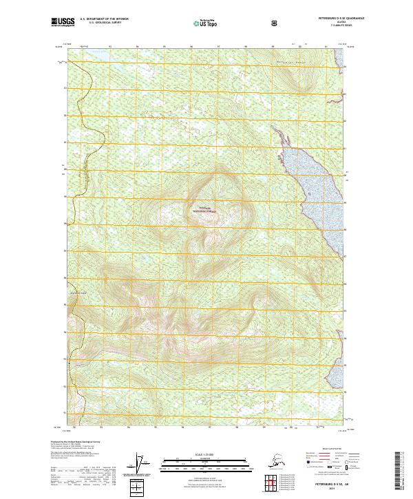
2021 Map of Petersburg D-5 SE
USGS Topo · Published 2021About this map
Kupreanof Island dominates this 2021 topographic map, revealing a landscape defined by the steep rises of the Bohemian Range. Located within the Tongass National Forest, the region shows a dense network of drainages and high-elevation relief typical of the Alexander Archipelago. The water systems are anchored by Towers Lake in the north and the southern flow of Taylor Cr. The boundary line between the Prince of Wales-Hyder Census Area and Petersburg Borough traverses the western portion of the island, cutting through the forest and rugged coastal terrain. This modern survey provides a detailed view of the complex hydrology and topography of Southeast Alaska before any major human infrastructure altered these specific interior reaches of the island.
Find a feature on this map
10 named features on this map. Tap any name to fly to it.
Don’t see what you’re looking for? This feature index may not catch every label — zoom into the map to look around manually.
Map Details
Editions of this 2021 Petersburg D-5 SE Map
This is the sole edition of this map. No revisions or reprints were ever made.
Other maps of this area

1948 · Petersburg C-4
USGS Topo · 1:63,360

1948 · Petersburg C-5
USGS Topo · 1:63,360

1948 · Petersburg D-5
USGS Topo · 1:63,360

1951 · Petersburg D-4
USGS Topo · 1:63,360

1951 · Petersburg C-4
USGS Topo · 1:63,360

1951 · Petersburg C-5
USGS Topo · 1:63,360

1952 · Petersburg
USGS Topo · 1:250,000

1960 · Petersburg
USGS Topo · 1:250,000
1995 · Petersburg C-4
USGS Topo · 1:63,360
1995 · Petersburg D-4
USGS Topo · 1:63,360