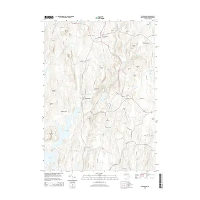
2015 Map of Petersham
USGS Topo · Published 2015About this map
Dana Center and the eastern reaches of the Quabbin Reservoir define this portion of Worcester County, where the landscape is marked by the legacy of mid-20th-century water management. The area is dense with family-named burial grounds and topographical landmarks, including Miles Holden Cem and Taylor Cem, providing significant touchpoints for genealogical research. Numerous hills like Camels Hump Hill, Raccoon Hill, and Bald Hill rise between the drainages of the East Branch Fever Brook and Moccasin Brook. The settlement of Petersham serves as a central hub, connected by a network of historic roads such as Old Dana Rd and Hardwick Rd that reflect the traditional travel patterns of central Massachusetts before modern highway expansion.
Find a feature on this map
101 named features on this map. Tap any name to fly to it.
Don’t see what you’re looking for? This feature index may not catch every label — zoom into the map to look around manually.
Map Details
Editions of this 2015 Petersham Map
This is the sole edition of this map. No revisions or reprints were ever made.
Other maps of this area

1887 · Warwick
USGS Topo · 1:62,500

1887 · Belchertown
USGS Topo · 1:62,500

1887 · Winchendon
USGS Topo · 1:62,500

1887 · Barre
USGS Topo · 1:62,500

1889 · Barre
USGS Topo · 1:62,500

1889 · Warwick
USGS Topo · 1:62,500

1890 · Belchertown
USGS Topo · 1:62,500

1890 · Winchendon
USGS Topo · 1:62,500

1893 · Belchertown
USGS Topo · 1:62,500

1894 · Winchendon
USGS Topo · 1:62,500