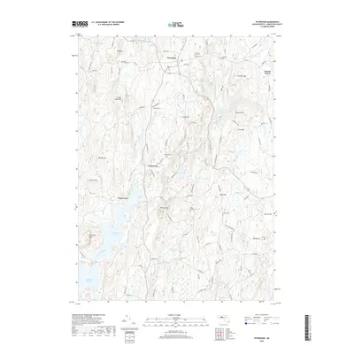
2018 Map of Petersham
USGS Topo · Published 2018About this map
The hills of Worcester County define this landscape, where the town of Petersham sits at a high elevation surrounded by numerous family-named peaks like Whitney Hill and Chimney Hill. This modern survey illustrates the proximity of the northern reaches of the Quabbin Reservoir, specifically the East Branch Swift River and Pottapaug Pond. The map serves as a vital resource for genealogical research, documenting several burial grounds including West Street Cem, East Street Cem, and the Miles Holden Cem. A notable geographic focus is Dana Center, a name preserved here despite the flooding of the valley in the mid-20th century. The intricate drainage network of Moccasin Brook and Danforth Brook highlights the hydrologic character of the region, while the layout of historic routes like the Monson Tpke Rd and Old Stage Rd provides clues to earlier transportation corridors through these uplands.
Find a feature on this map
105 named features on this map. Tap any name to fly to it.
Don’t see what you’re looking for? This feature index may not catch every label — zoom into the map to look around manually.
Map Details
Editions of this 2018 Petersham Map
This is the sole edition of this map. No revisions or reprints were ever made.
Other maps of this area

1887 · Warwick
USGS Topo · 1:62,500

1887 · Belchertown
USGS Topo · 1:62,500

1887 · Winchendon
USGS Topo · 1:62,500

1887 · Barre
USGS Topo · 1:62,500

1889 · Barre
USGS Topo · 1:62,500

1889 · Warwick
USGS Topo · 1:62,500

1890 · Belchertown
USGS Topo · 1:62,500

1890 · Winchendon
USGS Topo · 1:62,500

1893 · Belchertown
USGS Topo · 1:62,500

1894 · Winchendon
USGS Topo · 1:62,500