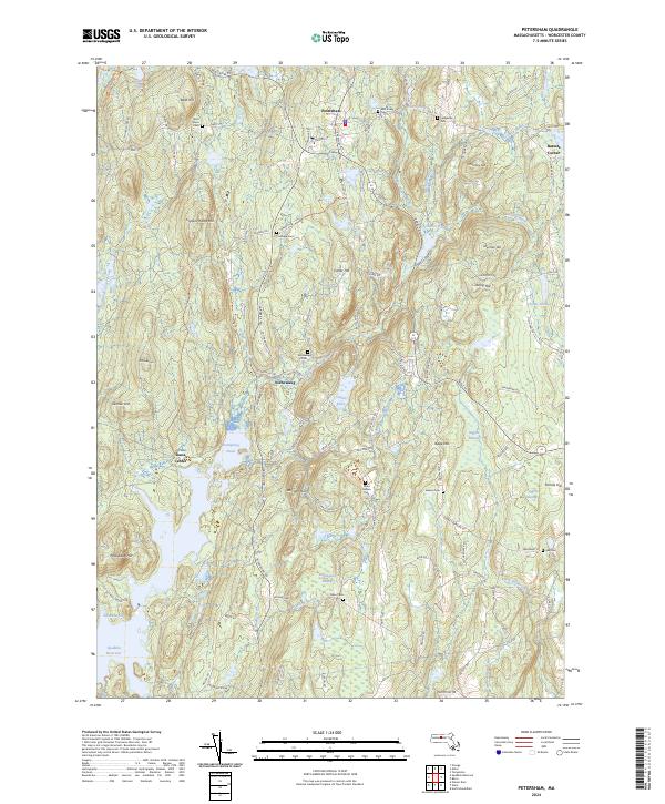
2024 Map of Petersham
USGS Topo · Published 2024About this map
Petersham anchors this Worcester County landscape, situated amidst a terrain of prominent peaks and protected waters. The southern reaches of the map are defined by the Quabbin Reservoir, where the shoreline at Albertines Cove and the waters of Pottapaug Pond meet the forest. This modern survey illustrates the enduring footprint of historic settlements, including the site of Dana Center and the village of Nichewaug. The distribution of family and community burial grounds, such as Miles Holden Cem, Jenkins Cem, and Coolidge Cem, provides a significant record of the area's genealogical history. Numerous brooks, including Moccasin Brook and Danforth Brook, drain the high ground between Bald Hill and Whitney Hill, flowing through extensive wetlands like Higgins Swamp and Hemingway Swamp. The network of old thoroughfares, from the Monson Tpke Rd to Old Hardwick Rd, connects these upland ridges and low-lying basins.
Find a feature on this map
108 named features on this map. Tap any name to fly to it.
Don’t see what you’re looking for? This feature index may not catch every label — zoom into the map to look around manually.
Map Details
Editions of this 2024 Petersham Map
This is the sole edition of this map. No revisions or reprints were ever made.
Other maps of this area

1887 · Warwick
USGS Topo · 1:62,500

1887 · Belchertown
USGS Topo · 1:62,500

1887 · Winchendon
USGS Topo · 1:62,500

1887 · Barre
USGS Topo · 1:62,500

1889 · Barre
USGS Topo · 1:62,500

1889 · Warwick
USGS Topo · 1:62,500

1890 · Belchertown
USGS Topo · 1:62,500

1890 · Winchendon
USGS Topo · 1:62,500

1893 · Belchertown
USGS Topo · 1:62,500

1894 · Winchendon
USGS Topo · 1:62,500