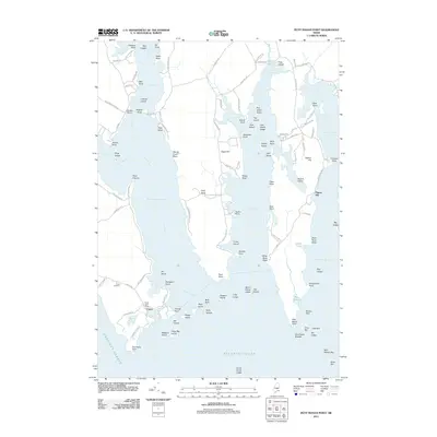
2011 Map of Petit Manan Point
USGS Topo · Published 2011About this map
Corea serves as the focal point of this coastal survey, where the village and the Corea Post Office sit at the southern end of a peninsula defined by its proximity to Prospect Harbor. The landscape is a complex network of peninsulas and inlets, including Gouldsboro Bay and Dyer Bay, separated by landmarks like Eagle Hill and Dyer Neck. This geography reveals a long history of maritime reliance, with numerous ledges and islands such as Lobster Island, Sheep Island, and Eastern Island dotting the waters.
Find a feature on this map
122 named features on this map. Tap any name to fly to it.
Don’t see what you’re looking for? This feature index may not catch every label — zoom into the map to look around manually.
Map Details
Editions of this 2011 Petit Manan Point Map
This is the sole edition of this map. No revisions or reprints were ever made.
Other maps of this area

1902 · Cherryfield
USGS Topo · 1:62,500

1904 · Cherryfield
USGS Topo · 1:62,500

1904 · Bar Harbor
USGS Topo · 1:62,500

1904 · Petit Manan
USGS Topo · 1:62,500

1930 · Tunk Lake
USGS Topo · 1:48,000

1932 · Tunk Lake
USGS Topo · 1:62,500

1942 · Bar Harbor
USGS Topo · 1:62,500

1942 · Cherryfield
USGS Topo · 1:62,500

1942 · Tunk Lake
USGS Topo · 1:62,500

1948 · Bangor
USGS Topo · 1:250,000