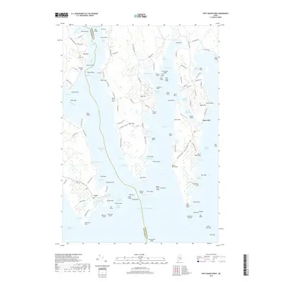
2018 Map of Petit Manan Point
USGS Topo · Published 2018About this map
The coastal village of Corea anchors this detailed survey of the Downeast Maine shoreline, where the Atlantic Ocean meets a complex network of harbors and points. The landscape is defined by the narrow passage of The Narrows and the protected waters of Corea Harbor and Gouldsboro Bay. This 2018 edition provides a high-resolution view of the local road network, including Redding Rd and Gouldsboro Point Rd, alongside significant local landmarks such as Eagle Hill and Pigeon Hill. Genealogists will find the locations of Haraden Cem and Corea Cem useful for tracing local family histories. The map meticulously documents the transition from the mainland to the numerous islands and ledges, such as Pop Island and Sheep Island, illustrating the maritime character of the area's geography and its connection to Steuben Harbor.
Find a feature on this map
150 named features on this map. Tap any name to fly to it.
Don’t see what you’re looking for? This feature index may not catch every label — zoom into the map to look around manually.
Map Details
Editions of this 2018 Petit Manan Point Map
This is the sole edition of this map. No revisions or reprints were ever made.
Other maps of this area

1902 · Cherryfield
USGS Topo · 1:62,500

1904 · Cherryfield
USGS Topo · 1:62,500

1904 · Bar Harbor
USGS Topo · 1:62,500

1904 · Petit Manan
USGS Topo · 1:62,500

1930 · Tunk Lake
USGS Topo · 1:48,000

1932 · Tunk Lake
USGS Topo · 1:62,500

1942 · Bar Harbor
USGS Topo · 1:62,500

1942 · Cherryfield
USGS Topo · 1:62,500

1942 · Tunk Lake
USGS Topo · 1:62,500

1948 · Bangor
USGS Topo · 1:250,000