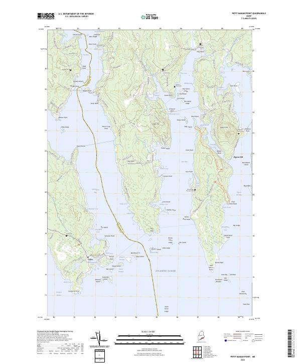
2024 Map of Petit Manan Point
USGS Topo · Published 2024About this map
The coastal village of Corea anchors this detailed study of the jagged Maine shoreline where Hancock and Washington Counties meet. The landscape is defined by the massive Petit Manan National Wildlife Refuge, which encompasses several peninsulas and offshore islands including Sheep Island and Lobster Island. For genealogists, the map is particularly rich with small, family-named burial grounds like Colewell-Huckins Cem, Robert Pinkham Cem, and the uniquely named All Souls By The Sea Cem near Dyer Bay.
Find a feature on this map
159 named features on this map. Tap any name to fly to it.
Don’t see what you’re looking for? This feature index may not catch every label — zoom into the map to look around manually.
Map Details
Editions of this 2024 Petit Manan Point Map
This is the sole edition of this map. No revisions or reprints were ever made.
Other maps of this area

1902 · Cherryfield
USGS Topo · 1:62,500

1904 · Cherryfield
USGS Topo · 1:62,500

1904 · Bar Harbor
USGS Topo · 1:62,500

1904 · Petit Manan
USGS Topo · 1:62,500

1930 · Tunk Lake
USGS Topo · 1:48,000

1932 · Tunk Lake
USGS Topo · 1:62,500

1942 · Bar Harbor
USGS Topo · 1:62,500

1942 · Cherryfield
USGS Topo · 1:62,500

1942 · Tunk Lake
USGS Topo · 1:62,500

1948 · Bangor
USGS Topo · 1:250,000