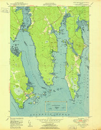
1950 Map of Petit Manan
USGS Topo · Published 1950About this map
The coastal village of Corea anchors this mid-century topographic study, showing the intricate relationship between the Downeast fishing economy and the granite-bound shoreline. Situated at the mouth of Gouldsboro Bay, the settlement is defined by Corea Harbor and a network of named points like Cranberry Point and Dolly Head. The landscape is dominated by extensive Heath wetlands and tidal mudflats, particularly around Dyer Harbor and Pinkham Bay. Inland, the settlement of Pigeon Hill sits near the prominence of the same name, while the historical Carrying Place indicates a traditional portage point between the harbor and Wood Pond Cove. This map captures a coastal topography prior to modern development, where family-named landmarks like Stanley Point and Rogers Point delineate the complex finger-like peninsulas of the Maine coast.
Find a feature on this map
112 named features on this map. Tap any name to fly to it.
Don’t see what you’re looking for? This feature index may not catch every label — zoom into the map to look around manually.
Map Details
Editions of this 1950 Petit Manan Map
This is the sole edition of this map. No revisions or reprints were ever made.
Other maps of this area

1902 · Cherryfield
USGS Topo · 1:62,500

1904 · Cherryfield
USGS Topo · 1:62,500

1904 · Bar Harbor
USGS Topo · 1:62,500

1904 · Petit Manan
USGS Topo · 1:62,500

1930 · Tunk Lake
USGS Topo · 1:48,000

1932 · Tunk Lake
USGS Topo · 1:62,500

1942 · Bar Harbor
USGS Topo · 1:62,500

1942 · Cherryfield
USGS Topo · 1:62,500

1942 · Tunk Lake
USGS Topo · 1:62,500

1948 · Bangor
USGS Topo · 1:250,000