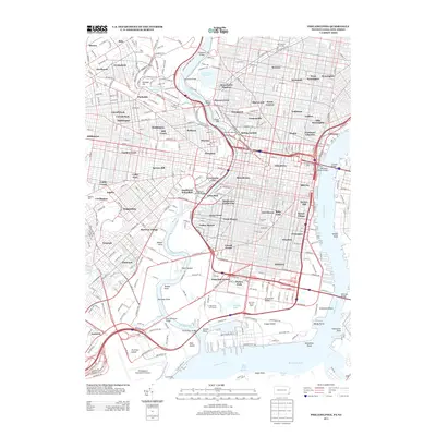
2013 Map of Philadelphia
USGS Topo · Published 2013About this map
The Schuylkill River and Delaware River define the intricate geography of Philadelphia in this 2013 survey, where dense urban grids meet extensive waterfront infrastructure. The map documents the city's complex landscape of neighborhoods, from the historic Fairmount Waterworks and Logan Circle to modern hubs like University City and the Philadelphia International Airport. This era of the city is characterized by a balance of residential clusters like Bartram Village and Strawberry Mansion with large-scale civic spaces, including East Park and the grounds of the F D Roosevelt Golf Course.
Find a feature on this map
125 named features on this map. Tap any name to fly to it.
Don’t see what you’re looking for? This feature index may not catch every label — zoom into the map to look around manually.
Map Details
Editions of this 2013 Philadelphia Map
This is the sole edition of this map. No revisions or reprints were ever made.
Other maps of this area

1891 · Philadelphia
USGS Topo · 1:62,500

1893 · Germantown
USGS Topo · 1:62,500

1894 · Chester
USGS Topo · 1:62,500

1894 · Philadelphia
USGS Topo · 1:62,500

1894 · Norristown
USGS Topo · 1:62,500

1894 · Germantown
USGS Topo · 1:62,500

1895 · Norristown
USGS Topo · 1:62,500

1896 · Germantown
USGS Topo · 1:62,500

1896 · Philadelphia
USGS Topo · 1:62,500

1896 · Norristown
USGS Topo · 1:62,500