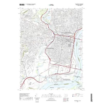
2019 Map of Philadelphia
USGS Topo · Published 2019About this map
Philadelphia and its surrounding riverfront communities are captured here in a period of dense urban density and complex transit infrastructure. The Schuylkill River and Delaware River define the city's core, bridged by monumental spans like the Walt Whitman Bridge and Franklin Bridge. This survey details the concentration of academic and cultural institutions in the city center, ranging from the University of Pennsylvania and Temple University to the Pennsylvania Academy of the Fine Arts.
Find a feature on this map
111 named features on this map. Tap any name to fly to it.
Don’t see what you’re looking for? This feature index may not catch every label — zoom into the map to look around manually.
Map Details
Editions of this 2019 Philadelphia Map
This is the sole edition of this map. No revisions or reprints were ever made.
Other maps of this area

1891 · Philadelphia
USGS Topo · 1:62,500

1893 · Germantown
USGS Topo · 1:62,500

1894 · Chester
USGS Topo · 1:62,500

1894 · Philadelphia
USGS Topo · 1:62,500

1894 · Norristown
USGS Topo · 1:62,500

1894 · Germantown
USGS Topo · 1:62,500

1895 · Norristown
USGS Topo · 1:62,500

1896 · Germantown
USGS Topo · 1:62,500

1896 · Philadelphia
USGS Topo · 1:62,500

1896 · Norristown
USGS Topo · 1:62,500