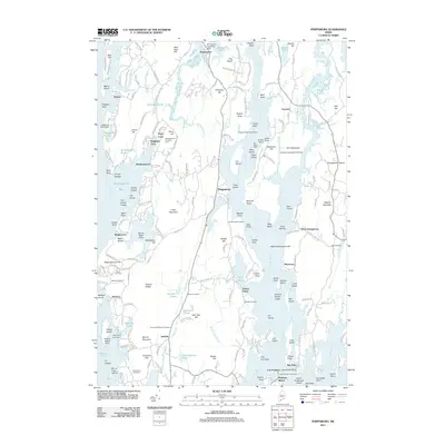
2011 Map of Phippsburg
USGS Topo · Published 2011About this map
Fort Popham stands at the mouth of the Kennebec River, anchoring a maritime landscape defined by tidal creeks and rocky points. This coastal Maine terrain is marked by historical settlements like Phippsburg, Arrowsic, and Popham Beach, where the economy and culture have long been tied to the water. The map traces the intricate shoreline from Winnegance Bay to Atkins Bay, revealing a network of local roads such as Sabino Rd and Meadowbrook Rd that connect inland hills like Tarrs Mountain to the sea.
Find a feature on this map
203 named features on this map. Tap any name to fly to it.
Don’t see what you’re looking for? This feature index may not catch every label — zoom into the map to look around manually.
Map Details
Editions of this 2011 Phippsburg Map
This is the sole edition of this map. No revisions or reprints were ever made.
Other maps of this area

1893 · Small Point
USGS Topo · 1:62,500

1893 · Boothbay
USGS Topo · 1:62,500

1894 · Bath
USGS Topo · 1:62,500

1919 · Small Point
USGS Topo · 1:62,500

1920 · Bath
USGS Topo · 1:62,500

1941 · Boothbay
USGS Topo · 1:62,500

1943 · Boothbay
USGS Topo · 1:62,500

1944 · Boothbay
USGS Topo · 1:62,500

1944 · Small Point
USGS Topo · 1:62,500

1945 · Bath
USGS Topo · 1:62,500