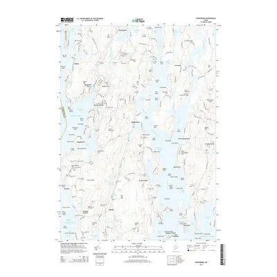
2014 Map of Phippsburg
USGS Topo · Published 2014About this map
Phippsburg and the surrounding islands and inlets of Sagadahoc County are documented in this contemporary survey, illustrating a landscape defined by its deep maritime heritage. The Kennebec River flows southward past Parker Head and Bay Point toward the open Atlantic Ocean, where the granite walls of Fort Popham stand guard over Atkins Bay. The region’s early history is evidenced by dozens of family and small-town burial grounds, including the Lombard Cem near Winnegance and the Lee Farm Cem on the peninsula.
Find a feature on this map
254 named features on this map. Tap any name to fly to it.
Don’t see what you’re looking for? This feature index may not catch every label — zoom into the map to look around manually.
Map Details
Editions of this 2014 Phippsburg Map
This is the sole edition of this map. No revisions or reprints were ever made.
Other maps of this area

1893 · Small Point
USGS Topo · 1:62,500

1893 · Boothbay
USGS Topo · 1:62,500

1894 · Bath
USGS Topo · 1:62,500

1919 · Small Point
USGS Topo · 1:62,500

1920 · Bath
USGS Topo · 1:62,500

1941 · Boothbay
USGS Topo · 1:62,500

1943 · Boothbay
USGS Topo · 1:62,500

1944 · Boothbay
USGS Topo · 1:62,500

1944 · Small Point
USGS Topo · 1:62,500

1945 · Bath
USGS Topo · 1:62,500