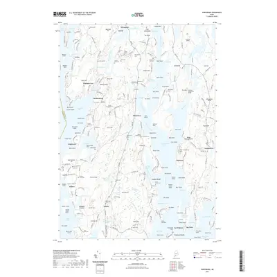
2021 Map of Phippsburg
USGS Topo · Published 2021About this map
The complex shoreline of the Kennebec River and its surrounding tidal waters characterize this coastal Maine landscape. Centered on the peninsula between Winnegance Bay and the river, the map details a region defined by its marine orientation, with numerous small harbors and coves such as Sebasco Harbor and Brighams Cove. Genealogy and local history are exceptionally well-represented through dozens of family burial sites, including the Lithgow Morse Farms Burying Ground and the Bartlett Family Cem. These sites, often located near private residences and farms, suggest a long-standing pattern of family-centered settlement across the rocky terrain of Rich Hill and Cushman Hill. The inland geography is a mixture of wetlands like Parker Head Swamp and numerous small water bodies such as Wah-Tuh Lake and Houghton Pond, illustrating the intricate drainage systems common to the Sagadahoc County coast.
Find a feature on this map
253 named features on this map. Tap any name to fly to it.
Don’t see what you’re looking for? This feature index may not catch every label — zoom into the map to look around manually.
Map Details
Editions of this 2021 Phippsburg Map
This is the sole edition of this map. No revisions or reprints were ever made.
Other maps of this area

1893 · Small Point
USGS Topo · 1:62,500

1893 · Boothbay
USGS Topo · 1:62,500

1894 · Bath
USGS Topo · 1:62,500

1919 · Small Point
USGS Topo · 1:62,500

1920 · Bath
USGS Topo · 1:62,500

1941 · Boothbay
USGS Topo · 1:62,500

1943 · Boothbay
USGS Topo · 1:62,500

1944 · Boothbay
USGS Topo · 1:62,500

1944 · Small Point
USGS Topo · 1:62,500

1945 · Bath
USGS Topo · 1:62,500