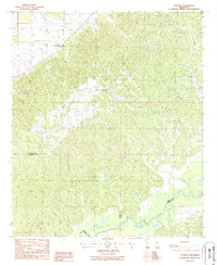
1988 Map of Phoenix
USGS Topo · Published 1988About this map
Big Black River meanders across the southern boundary of this late-1980s topographic survey, marking the intersection of Yazoo, Warren, and Hinds counties. The landscape is defined by the heavy dissection of the loess bluffs above the river valley, where numerous watercourses like Beaver Creek and Bear Creek have carved deep drainage patterns. The settlement of Phoenix serves as a local hub, characterized by the prominent Fire Tower Phoenix and nearby church and school sites. Further northwest, the small community of Germania sits along the ridges, reflecting the upland agricultural and timber patterns of this rural Mississippi region. Genealogists may find interest in several small Cem locations scattered throughout the hills, indicating family or community burial grounds tucked away from the main roads.
Find a feature on this map
12 named features on this map. Tap any name to fly to it.
Don’t see what you’re looking for? This feature index may not catch every label — zoom into the map to look around manually.
Map Details
Editions of this 1988 Phoenix Map
This is the sole edition of this map. No revisions or reprints were ever made.
Other maps of this area

1903 · Jackson
USGS Topo · 1:125,000

1934 · Raymond
USGS Topo · 1:48,000

1937 · Raymond
USGS Topo · 1:62,500

1938 · Edwards
USGS Topo · 1:62,500

1940 · Mechanicsburg
USGS Topo · 1:62,500

1942 · Raymond
USGS Topo · 1:62,500

1955 · Jackson
USGS Topo · 1:250,000

1961 · Jackson
USGS Topo · 1:250,000

1962 · Jackson
USGS Topo · 1:250,000

1962 · Flora
USGS Topo · 1:62,500