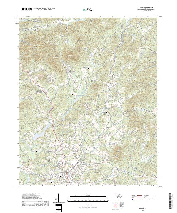
2024 Map of Pickens
USGS Topo · Published 2024About this map
The town of Pickens serves as the focal point of this South Carolina landscape, where the County Courthouse and local institutions like the Pickens Presbyterian Church Graveyard mark the seat of government and community life. The terrain is defined by the transition from the Blue Ridge foothills to the Piedmont, characterized by prominent elevations such as Glassy Mtn and Walnut Cove Mtn. Water drainage is managed through a complex network of creeks, including the North Fork Twelvemile Creek and Town Creek, with the significant Twelve-Mile Watershed Structure highlighting mid-century conservation efforts.
Find a feature on this map
202 named features on this map. Tap any name to fly to it.
Don’t see what you’re looking for? This feature index may not catch every label — zoom into the map to look around manually.
Map Details
Editions of this 2024 Pickens Map
This is the sole edition of this map. No revisions or reprints were ever made.
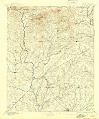
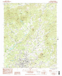
Historical Maps of Midway Through Time
4 maps found