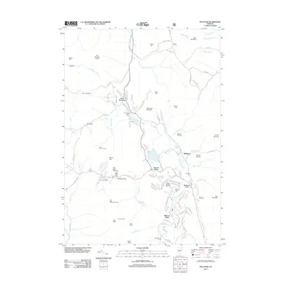
2012 Map of Pico Peak
USGS Topo · Published 2012About this map
Sherburne Center and the surrounding resort communities sit at the heart of this mountain landscape, where the recreation economy and traditional valley settlements converge. The area is defined by the high elevations of Pico Peak and Sable Mountain, with the Appalachian Trl winding through the terrain near Willard Gap and Sherburne Pass. The map documents the residential and commercial density of Killington Village and Telemark Village contrasted against the agricultural and family heritage found at Riverside Cem and the Anthony Family Cem. Waterways like the Ottauquechee River and Roaring Brook carve through the valleys, supporting both the natural ecosystem and the development of the Pico Peak Ski Area. Evidence of early backcountry travel is preserved through named landmarks such as the Rolston Rest Shelter and the Tucker Johnson Shelter, which serve as vital points for hikers navigating the Green Mountains.
Find a feature on this map
113 named features on this map. Tap any name to fly to it.
Don’t see what you’re looking for? This feature index may not catch every label — zoom into the map to look around manually.
Map Details
Editions of this 2012 Pico Peak Map
This is the sole edition of this map. No revisions or reprints were ever made.
Other maps of this area

1891 · Rutland
USGS Topo · 1:62,500

1893 · Rutland
USGS Topo · 1:62,500

1911 · Woodstock
USGS Topo · 1:62,500

1913 · Woodstock
USGS Topo · 1:62,500

1915 · Rochester
USGS Topo · 1:62,500

1917 · Rochester
USGS Topo · 1:62,500

1919 · Royalton
USGS Topo · 1:62,500

1924 · Randolph
USGS Topo · 1:48,000

1926 · Randolph
USGS Topo · 1:62,500

1943 · Woodstock
USGS Topo · 1:62,500