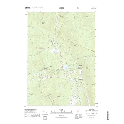
2018 Map of Pico Peak
USGS Topo · Published 2018About this map
Pico Peak and the Coolidge Range dominate this Vermont landscape, where the high-elevation terrain is crisscrossed by world-renowned hiking routes. The Long Trail and the Appalachian National Scenic Trail converge near Sherburne Pass, winding past dramatic geological features like Deer Leap Rock and the water bodies of Kent Pond and Pico Pond. This region, situated within the Green Mountain National Forest, shows a pattern of settlement clustered in the valleys along the Ottauquechee River and the South Branch Tweed River. Local history is anchored by small communities such as Sherburne Center and North Sherburne. Genealogists may find interest in several family burial sites, including the Anthony Family Cem and Riverside Cem, which are located near the riverside roads that have historically connected these mountain towns.
Find a feature on this map
99 named features on this map. Tap any name to fly to it.
Don’t see what you’re looking for? This feature index may not catch every label — zoom into the map to look around manually.
Map Details
Editions of this 2018 Pico Peak Map
This is the sole edition of this map. No revisions or reprints were ever made.
Other maps of this area

1891 · Rutland
USGS Topo · 1:62,500

1893 · Rutland
USGS Topo · 1:62,500

1911 · Woodstock
USGS Topo · 1:62,500

1913 · Woodstock
USGS Topo · 1:62,500

1915 · Rochester
USGS Topo · 1:62,500

1917 · Rochester
USGS Topo · 1:62,500

1919 · Royalton
USGS Topo · 1:62,500

1924 · Randolph
USGS Topo · 1:48,000

1926 · Randolph
USGS Topo · 1:62,500

1943 · Woodstock
USGS Topo · 1:62,500