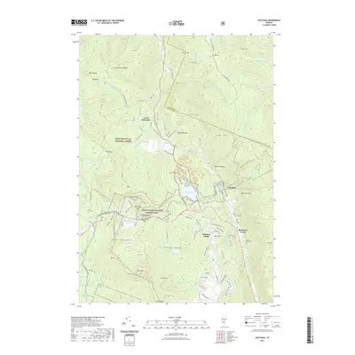
2021 Map of Pico Peak
USGS Topo · Published 2021About this map
Sherburne Center and North Sherburne anchor this high-elevation landscape in the heart of the Green Mountain National Forest. The 2021 survey illustrates the modern intersection of Vermont's classic mountain terrain and its intensive outdoor recreation economy, centered on Pico Peak and the surrounding Coolidge Range. The map documents a dense network of transit and heritage routes, including the Long Trl and the Appalachian National Scenic Trail, which converge near Sherburne Pass. Local history is preserved in smaller landmarks like Riverside Cem and the Anthony Family Cem, while the drainage of the Ottauquechee River and Kent Pond defines the valley floor. The geography here is characterized by steep summits like Deer Leap Mtn and Wolf Hill, separated by narrow gaps that have dictated travel in Rutland County for generations.
Find a feature on this map
110 named features on this map. Tap any name to fly to it.
Don’t see what you’re looking for? This feature index may not catch every label — zoom into the map to look around manually.
Map Details
Editions of this 2021 Pico Peak Map
This is the sole edition of this map. No revisions or reprints were ever made.
Other maps of this area

1891 · Rutland
USGS Topo · 1:62,500

1893 · Rutland
USGS Topo · 1:62,500

1911 · Woodstock
USGS Topo · 1:62,500

1913 · Woodstock
USGS Topo · 1:62,500

1915 · Rochester
USGS Topo · 1:62,500

1917 · Rochester
USGS Topo · 1:62,500

1919 · Royalton
USGS Topo · 1:62,500

1924 · Randolph
USGS Topo · 1:48,000

1926 · Randolph
USGS Topo · 1:62,500

1943 · Woodstock
USGS Topo · 1:62,500