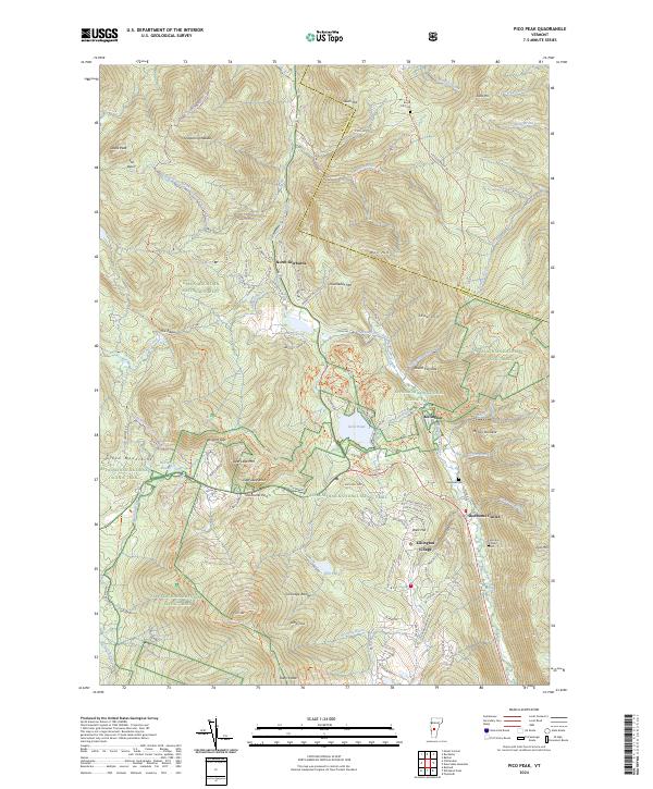
2024 Map of Pico Peak
USGS Topo · Published 2024About this map
Pico Peak and the surrounding Coolidge Range dominate this part of the Green Mountain National Forest, where the landscape is defined by high ridgelines and the headwaters of the Ottauquechee River. The topography transitions from the steep slopes of Sable Mtn and Wolf Hill down to the established settlements of Killington Village and Sherburne Center. This modern survey illustrates how recreation and small-town infrastructure coexist within the protected forest boundaries, with a dense network of roads like Killington Rd and River Rd providing access to the valley floors.
Find a feature on this map
95 named features on this map. Tap any name to fly to it.
Don’t see what you’re looking for? This feature index may not catch every label — zoom into the map to look around manually.
Map Details
Editions of this 2024 Pico Peak Map
This is the sole edition of this map. No revisions or reprints were ever made.
Other maps of this area

1891 · Rutland
USGS Topo · 1:62,500

1893 · Rutland
USGS Topo · 1:62,500

1911 · Woodstock
USGS Topo · 1:62,500

1913 · Woodstock
USGS Topo · 1:62,500

1915 · Rochester
USGS Topo · 1:62,500

1917 · Rochester
USGS Topo · 1:62,500

1919 · Royalton
USGS Topo · 1:62,500

1924 · Randolph
USGS Topo · 1:48,000

1926 · Randolph
USGS Topo · 1:62,500

1943 · Woodstock
USGS Topo · 1:62,500