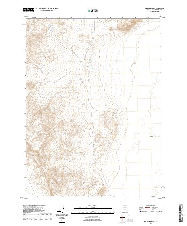
2021 Map of Pidgeon Spring
USGS Topo · Published 2021About this map
Black Rock Desert landscape dominates the eastern portion of this quadrangle, where the arid basin meets the foothills of Humboldt County. Water is the primary driver of geography here, with Pidgeon Spring and Indian Springs serving as vital landmarks in an otherwise dry terrain. The map traces the intermittent course of Indian Cr as it flows toward the desert floor. This 2021 survey utilizes data from the U.S. Census Bureau and the Bureau of Land Management to delineate the complex township and range boundaries, such as t38n r27e, which overlay the shifting sands and elevation contours of the Great Basin.
Find a feature on this map
11 named features on this map. Tap any name to fly to it.
Don’t see what you’re looking for? This feature index may not catch every label — zoom into the map to look around manually.
Map Details
Editions of this 2021 Pidgeon Spring Map
This is the sole edition of this map. No revisions or reprints were ever made.
Other maps of this area

1886 · Disaster
USGS Topo · 1:250,000

1889 · Long Valley
USGS Topo · 1:250,000

1893 · Disaster
USGS Topo · 1:250,000

1954 · Vya
USGS Topo · 1:250,000

1958 · Vya
USGS Topo · 1:250,000

1962 · Vya
USGS Topo · 1:250,000

1972 · Pinto Mountain
USGS Topo · 1:24,000

1972 · Big Mountain
USGS Topo · 1:24,000
1972 · Paiute Meadows
USGS Topo · 1:24,000
1979 · Double Hot Springs
USGS Topo · 1:24,000