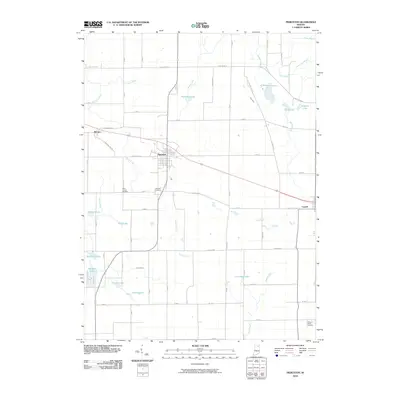
2010 Map of Pierceton
USGS Topo · Published 2010About this map
Pierceton serves as the central hub of this northern Indiana landscape, where the town's grid is situated between Pierceton Lake and several smaller water bodies. The terrain is defined by a dense network of agricultural drainage systems, including the Shanton Ditch, Leedy Ditch, and French Ditch, reflecting a long history of land management for farming. These waterways feed into larger natural features like Robinson Lake and Reed Lake, illustrating the glacial lake topography of the region.
Find a feature on this map
53 named features on this map. Tap any name to fly to it.
Don’t see what you’re looking for? This feature index may not catch every label — zoom into the map to look around manually.
Map Details
Editions of this 2010 Pierceton Map
This is the sole edition of this map. No revisions or reprints were ever made.
Other maps of this area

1950 · Leesburg
USGS Topo · 1:24,000

1950 · Pierceton
USGS Topo · 1:24,000

1950 · North Webster
USGS Topo · 1:24,000

1951 · Ormas
USGS Topo · 1:24,000

1953 · Fort Wayne
USGS Topo · 1:250,000

1956 · Fort Wayne
USGS Topo · 1:250,000

1956 · Lorane
USGS Topo · 1:24,000

1957 · Warsaw
USGS Topo · 1:24,000
1962 · North Manchester North
USGS Topo · 1:24,000
1962 · South Whitley West
USGS Topo · 1:24,000